Albsteig-Portal
Location: Albbruck
Accessibility: Accesso limitato in sedia a rotelle
GPS coordinates: 47.59164,8.13048
Latest update: November 22, 2025 08:32
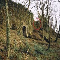
Burg Hauenstein
2.1 km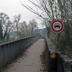
Rheinbrücke Albbruck–Schwaderloch
609 m
Schneeglöckchenstandort auf Gemarkung Buch, Landkreis Waldshut
1.8 km
Oberes Bürgli, part of the late Roman Rhine fortifications
1.4 km
Oberer Bürgli
1.4 km
Dreispitz
864 m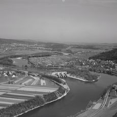
"Untere Auinsel"
786 m
Unteres Bürgli, part of the late Roman Rhine fortifications
1.2 km
"Obere-Auinsel I"
571 m
Wayside cross
1.3 km
Salpeterer 1739
314 m
Wayside cross
2.3 km
Wayside cross
1.3 km
Wayside cross
826 m
Scenic viewpoint
2.4 km
Wayside cross
2 km
Wayside cross
1.8 km
Güggel-Kreuz
2.2 km
Wayside shrine
2.2 km
Wayside cross
1.8 km
Wayside cross
2.1 km
Wayside cross
2.1 km
Wayside cross
1.7 km
Memorial, commemorative plaque
529 m
Wayside cross
504 m
Memorial, war memorial
44 m
Birkinger Wasserfall
2.3 km
Rickenbach-Wasserfall
1.2 kmReviews
Visited this place? Tap the stars to rate it and share your experience / photos with the community! Try now! You can cancel it anytime.
Discover hidden gems everywhere you go!
From secret cafés to breathtaking viewpoints, skip the crowded tourist spots and find places that match your style. Our app makes it easy with voice search, smart filtering, route optimization, and insider tips from travelers worldwide. Download now for the complete mobile experience.

A unique approach to discovering new places❞
— Le Figaro
All the places worth exploring❞
— France Info
A tailor-made excursion in just a few clicks❞
— 20 Minutes