Anker
Location: Ginsheim-Gustavsburg
GPS coordinates: 49.96309,8.34371
Latest update: November 18, 2025 02:12
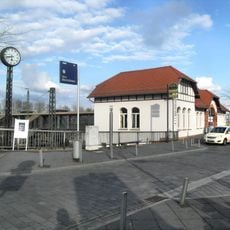
Mainz-Bischofsheim station
3.3 km
Christkönig
3.3 km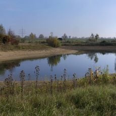
Laubenheimer-Bodenheimer Ried
2.4 km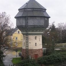
Bischofsheim water tower
3.3 km
Church of the Visitation
2.4 km
Bait ul-Ghafur Mosque
3.1 km
Böhmische Burg Astheim
2.1 km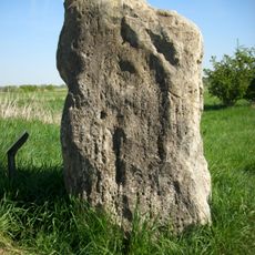
Menhir von Mainz-Laubenheim
2.5 km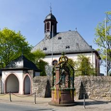
Evangelische Kirche Bauschheim
2.3 km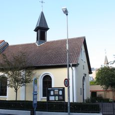
Evangelische Kirche
2.3 km
Evangelische Kirche
3 km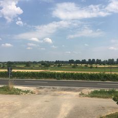
Erweiterung Laubenheimer - Bodenheimer Ried
3 km
NSG Laubenheimer-Bodenheimer Ried
2.2 km
NSG Laubenheimer-Bodenheimer Ried
2.4 km
Grünland im Bereich der Herrenwiese nordwestlich Astheim
2.9 km
Mainmündung und Ginsheimer Altrhein
986 m
Ginsheimer Altrhein
2.1 km
Erhalt der Laubenheimer Höhe
2.7 km
Am Steinbruch
2.9 km
Scenic viewpoint
2.5 km
Work of art, sculpture
2.4 km
Hans-Zöller-Kreuz
2.7 km
Wayside cross, Christianity
1.8 km
Wiegehäuschen
2.4 km
Wayside cross, Christianity
3.3 km
Laubenheimer Ausscheller
2.4 km
Christianity, Catholic church building, wayside cross
2.5 km
Wayside cross
895 mReviews
Visited this place? Tap the stars to rate it and share your experience / photos with the community! Try now! You can cancel it anytime.
Discover hidden gems everywhere you go!
From secret cafés to breathtaking viewpoints, skip the crowded tourist spots and find places that match your style. Our app makes it easy with voice search, smart filtering, route optimization, and insider tips from travelers worldwide. Download now for the complete mobile experience.

A unique approach to discovering new places❞
— Le Figaro
All the places worth exploring❞
— France Info
A tailor-made excursion in just a few clicks❞
— 20 Minutes