Kirschblütenallee
Location: Lülsdorf
Location: Niederkassel
GPS coordinates: 50.83251,7.02143
Latest update: November 23, 2025 03:28
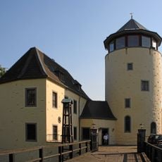
Burg Lülsdorf
958 m
Hochwasserschutzbecken Langeler Bogen
2 km
Römerlager Wesseling
2.1 km
St. Jakobus
775 m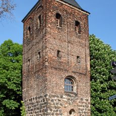
Alter Turm
1 km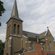
St. Clemens
1.9 km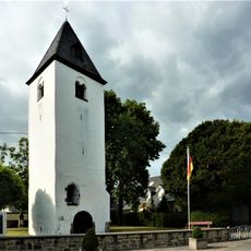
Alter Turm
747 m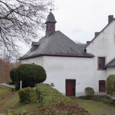
Luziakapelle
2.4 km
LSG-Landschaftskorridore
1.4 km
Weilerhofer See
2.3 km
LSG-Urfelder Weiden und Rhein
1.6 km
Kiesgrube Ranzel
633 m
Scenic viewpoint
2.3 km
Wayside cross
1 km
KreativHof
997 m
Wayside cross
2 km
Wayside cross
486 m
Kreuz
759 m
Wayside cross
2 km
Scenic viewpoint
2 km
Memorial
914 m
Peterskreuz
904 m
Wayside cross
854 m
War memorial, memorial
746 m
Wayside cross
710 m
Wayside shrine
211 m
Christianity, Catholic church building, wayside cross
2.4 km
Christianity, Catholic church building, wayside cross
894 mReviews
Visited this place? Tap the stars to rate it and share your experience / photos with the community! Try now! You can cancel it anytime.
Discover hidden gems everywhere you go!
From secret cafés to breathtaking viewpoints, skip the crowded tourist spots and find places that match your style. Our app makes it easy with voice search, smart filtering, route optimization, and insider tips from travelers worldwide. Download now for the complete mobile experience.

A unique approach to discovering new places❞
— Le Figaro
All the places worth exploring❞
— France Info
A tailor-made excursion in just a few clicks❞
— 20 Minutes