Vogtländische Latschenkiefer
Location: Auerbach/Vogtland
GPS coordinates: 50.47973,12.46578
Latest update: October 11, 2024 04:02
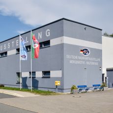
Deutsche Raumfahrtausstellung Morgenröthe-Rautenkranz
2.7 km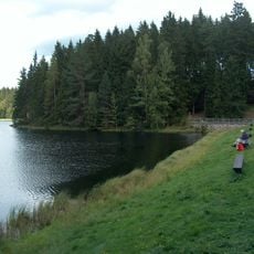
Vogtlandsee
1.9 km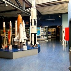
Deutsche Raumfahrtausstellung Morgenröthe-Rautenkranz e.V.
2.8 km
Grünheider Hochmoor
1.1 km
Laubberg
2.7 km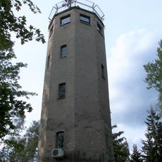
Carlsturm
1.4 km
Kirche (mit Ausstattung) Am Kirchberg 4
2.8 km
Einzeldenkmale der Sachgesamtheit Heilstätte Bad Reiboldsgrün Waldhofstraße 1; 3
1.3 km
Albertsberg
1 km
Forsthaus mit Garten und Einfriedung Rautenkranzer Straße 2
579 m
Bad Reiboldsgrün
1.3 km
Carolagrün
2 km
Kriegerdenkmal Albertsberger Straße 7 (bei)
2.2 km
Königlich-Sächsische Meilensteine (Sachgesamtheit) Vogelsgrün
808 m
Königlich-Sächsische Meilensteine (Sachgesamtheit) Auerbach/Vogtl.
2.6 km
Wegestein Beerheide
2.3 km
Wettinstein in Schönheide
2.6 km
Work of art, sculpture
2.7 km
Vogtlandblick
2.2 km
Wettindenkmal
2.6 km
Scenic viewpoint
1.2 km
Work of art, sculpture
2.7 km
Alte Bahnstrecke
2.6 km
Scenic viewpoint
1.4 km
MIG21-F13
2.8 km
Gedenkstätte der Gefallenen des 1. Weltkrieges
2.2 km
Stele zur Erinnerung an den Weltraumflug des ersten Deutschen
2.8 km
Scenic viewpoint
2.8 kmReviews
Visited this place? Tap the stars to rate it and share your experience / photos with the community! Try now! You can cancel it anytime.
Discover hidden gems everywhere you go!
From secret cafés to breathtaking viewpoints, skip the crowded tourist spots and find places that match your style. Our app makes it easy with voice search, smart filtering, route optimization, and insider tips from travelers worldwide. Download now for the complete mobile experience.

A unique approach to discovering new places❞
— Le Figaro
All the places worth exploring❞
— France Info
A tailor-made excursion in just a few clicks❞
— 20 Minutes