Régi tűzoltókocsi
Location: Szentgotthárd
Accessibility: Wheelchair inaccessible
GPS coordinates: 46.90251,16.31553
Latest update: October 11, 2024 04:43

Szentgotthárd Abbey
6.5 km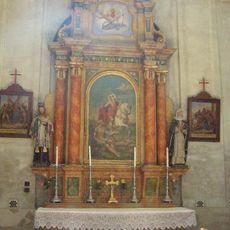
Church of St. Stephen Harding in Apátistvánfalva
4.5 km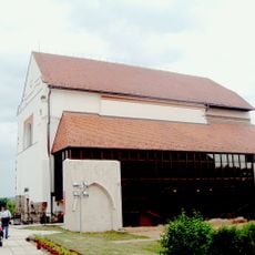
Theatre in Szentgotthárd (former granary church)
6.6 km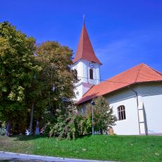
St. Nicholas's Parish Church
6.1 km
Gomilno grobišče Sočina graba
4.9 km
Domačija Dolenci 12
5.8 km
Gomilno grobišče v Benkovi šumi
5.4 km
Az éjszaka hangjai kiállítás
4.6 km
Scenic viewpoint
4.5 km
A Fekete-tó legendája
4.8 km
Régi tűzoltó szivattyú
4.9 km
Tökmagolajütő
4.6 km
Tower, Observation tower, scenic viewpoint
5.4 km
Termesztett növények
4.6 km
Életfa
5.6 km
Jégverem
5.6 km
Scenic viewpoint
4.5 km
Mária-szobor
5.8 km
Statue, Work of art
4.8 km
Nagy hal
6.3 km
Halak
6.3 km
Work of art, sculpture
6.4 km
Work of art, sculpture
6.4 km
Work of art, sculpture
6.4 km
Work of art, sculpture
6.5 km
Work of art, sculpture
6.5 km
St.Gotthard Spa & Wellness
6.5 km
Scenic viewpoint
4.4 kmReviews
Visited this place? Tap the stars to rate it and share your experience / photos with the community! Try now! You can cancel it anytime.
Discover hidden gems everywhere you go!
From secret cafés to breathtaking viewpoints, skip the crowded tourist spots and find places that match your style. Our app makes it easy with voice search, smart filtering, route optimization, and insider tips from travelers worldwide. Download now for the complete mobile experience.

A unique approach to discovering new places❞
— Le Figaro
All the places worth exploring❞
— France Info
A tailor-made excursion in just a few clicks❞
— 20 Minutes