Þorsteinslundur
Location: Rangárþing eystra
GPS coordinates: 63.72114,-19.90961
Latest update: October 11, 2024 04:45
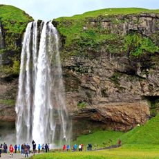
Seljalandsfoss
12.4 km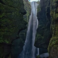
Gljufrafoss
11.8 km
Merkjárfoss
856 m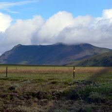
Þríhyrningur
8 km
Þórðarfoss
556 m
Waterfall
8.2 km
Drumbabót
10.2 km
Þverárvöllur
6.8 km
Work of art, sculpture
1.7 km
Waterfall
8.1 km
Waterfall
8.1 km
DC-3 Airplane wreck Eyvindarholt
8.1 km
Waterfall
8.2 km
Scenic viewpoint
865 m
Waterfall
8.6 km
Stigafoss
10.2 km
Nauthúsafoss
6.5 km
Scenic viewpoint
11.8 km
Waterfall
854 m
Scenic viewpoint
11.8 km
Waterfall
12 km
Waterfall
12.2 km
Scenic viewpoint
12.3 km
Waterfall
12.3 km
Drífandi
74 m
Work of art
12.6 km
View photo point
12.6 km
Drífandi
13.5 kmReviews
Visited this place? Tap the stars to rate it and share your experience / photos with the community! Try now! You can cancel it anytime.
Discover hidden gems everywhere you go!
From secret cafés to breathtaking viewpoints, skip the crowded tourist spots and find places that match your style. Our app makes it easy with voice search, smart filtering, route optimization, and insider tips from travelers worldwide. Download now for the complete mobile experience.

A unique approach to discovering new places❞
— Le Figaro
All the places worth exploring❞
— France Info
A tailor-made excursion in just a few clicks❞
— 20 Minutes