Wasserhüs
Location: Albinen
Operator: Wasserhüs Albinen
GPS coordinates: 46.34024,7.63407
Latest update: November 19, 2025 11:21

Pont des Gorges de la Dala
2.9 km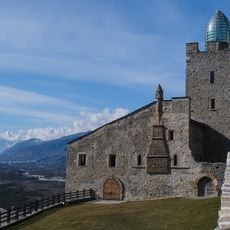
Leuk Castle
2.7 km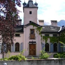
Zen-Ruffinen Castle
2.6 km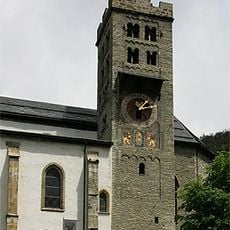
St. Stephan church
2.5 km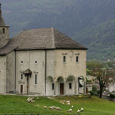
Ringacker chapel of the immaculate conception with hermitage
2.9 km
Saint Brother Klaus Parish Church
59 m
Dala tower
2.8 km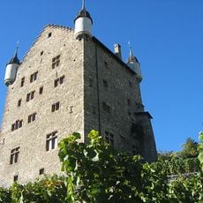
City hall
2.7 km
Holy Family chapel
2.3 km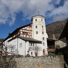
Major yard of Werra Galdinen
2.5 km
Horlini
3 km
Juon House
2.5 km
Schützenlaube
2.7 km
Mageran house
2.6 km
Alte Kür
2.5 km
Arch bridge over the Dala
952 m
Parco naturale Pfyn-Finges
2.5 km
Parish and Zenden archives in the rectory
2.5 km
Scenic viewpoint
1.9 km
Beinhaus
2.5 km
Scenic viewpoint
2.5 km
Scenic viewpoint
2.4 km
Scenic viewpoint
1.7 km
Scenic viewpoint
2.3 km
Scenic viewpoint
2.3 km
Tower, Observation tower, scenic viewpoint
338 m
Scenic viewpoint
2.8 km
Scenic viewpoint
2.9 kmReviews
Visited this place? Tap the stars to rate it and share your experience / photos with the community! Try now! You can cancel it anytime.
Discover hidden gems everywhere you go!
From secret cafés to breathtaking viewpoints, skip the crowded tourist spots and find places that match your style. Our app makes it easy with voice search, smart filtering, route optimization, and insider tips from travelers worldwide. Download now for the complete mobile experience.

A unique approach to discovering new places❞
— Le Figaro
All the places worth exploring❞
— France Info
A tailor-made excursion in just a few clicks❞
— 20 Minutes