Standing Rock
Location: Regional District of Okanagan-Similkameen
GPS coordinates: 49.21716,-119.91459
Latest update: November 20, 2025 06:55
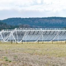
Canadian Hydrogen Intensity Mapping Experiment
24.1 km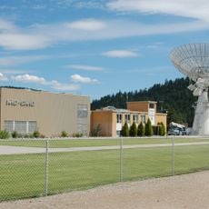
Dominion Radio Astrophysical Observatory
24.3 km
South Okanagan-Similkameen National Park
18.9 km
Cathedral Provincial Park and Protected Area
25.7 km
Keremeos Columns Provincial Park
9.8 km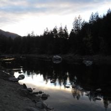
Stemwinder Provincial Park
23.5 km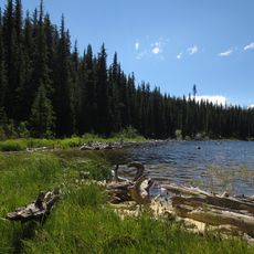
Nickel Plate Provincial Park
20.9 km
White Lake Grasslands Protected Area
24.6 km
Snowy Protected Area
17.9 km
Cathedral Provincial Park
24.8 km
South Okanagan Grasslands Protected Area
23.4 km
Arnold Peak
25.4 km
Snowshoe Mountain
25.8 km
Cathedral Protected Area
17.4 km
Mahoney Lake Ecological Reserve
25.5 km
Keremeos Quail
6.4 km
Fairview Mountain Golf Club
24.1 km
Keremeos Columns
9.7 km
The Grist Mill and Gardens
7.8 km
Monk's Cave
22.1 km
St. Andrews By-The-Lake
24.5 km
Yellow Lake
16.9 km
Scenic viewpoint
25.1 km
View over devil's woodpile and Cathedral ridge
20.2 km
Scenic viewpoint
20.3 km
Scenic viewpoint
20.9 km
Scenic viewpoint
19.1 km
Scenic viewpoint
7.9 kmReviews
Visited this place? Tap the stars to rate it and share your experience / photos with the community! Try now! You can cancel it anytime.
Discover hidden gems everywhere you go!
From secret cafés to breathtaking viewpoints, skip the crowded tourist spots and find places that match your style. Our app makes it easy with voice search, smart filtering, route optimization, and insider tips from travelers worldwide. Download now for the complete mobile experience.

A unique approach to discovering new places❞
— Le Figaro
All the places worth exploring❞
— France Info
A tailor-made excursion in just a few clicks❞
— 20 Minutes