Chesaw Rodeo Grounds
Location: Okanogan County
GPS coordinates: 48.94438,-119.05039
Latest update: November 22, 2025 14:26
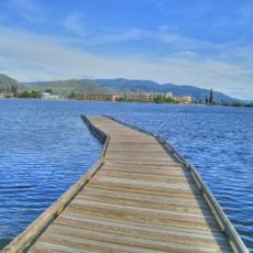
Osoyoos Lake
29.5 km
Anarchist Protected Area
29.4 km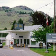
Ferry-Midway Border Crossing
22 km
Zosel Dam
27 km
Conkle Lake Provincial Park
25 km
Osoyoos Lake State Park
28 km
Kettle River Recreation Area
18.7 km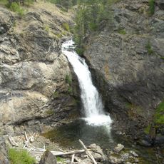
Boundary Falls
27.2 km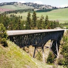
Rock Creek Canyon Bridge
12.6 km
Boundary Creek Provincial Park
29 km
Johnstone Creek Provincial Park
11.8 km
Саут-Оканаган-Лоуэр-Симилкамин (национальный парк)
28.4 km
Lost Lake Guard Station
11.1 km
Rock Creek Park
12.2 km
Bonaparte Lake
16 km
Beth Lake
10.3 km
Charles And Mary Eder Wildlife Area
23.5 km
Chesaw Wildlife Area
2.7 km
Driscoll Island Wildlife Area
28 km
Sonora Dunes Golf Course
29.7 km
Kettle Valley Golf Club
16.1 km
Wakepilot
29.4 km
Walnut Beach Resort
29.4 km
Striding Sasquatch
22.1 km
Anarchist Mountain Lookout
27 km
Scenic viewpoint
26.7 km
Scenic viewpoint
29.8 km
Railway carriage
20.7 kmReviews
Visited this place? Tap the stars to rate it and share your experience / photos with the community! Try now! You can cancel it anytime.
Discover hidden gems everywhere you go!
From secret cafés to breathtaking viewpoints, skip the crowded tourist spots and find places that match your style. Our app makes it easy with voice search, smart filtering, route optimization, and insider tips from travelers worldwide. Download now for the complete mobile experience.

A unique approach to discovering new places❞
— Le Figaro
All the places worth exploring❞
— France Info
A tailor-made excursion in just a few clicks❞
— 20 Minutes