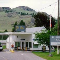
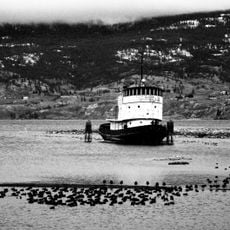
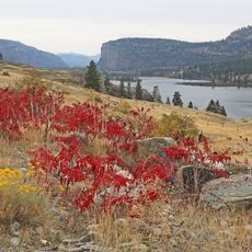
Osoyoos Lake, International lake in Okanagan Valley, Canada and Washington, United States.
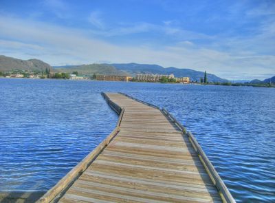
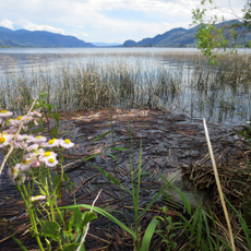
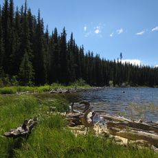
Osoyoos Lake is an international body of water stretching roughly 18 kilometers (11 miles) in length, divided between Canada and the United States at the 49th parallel. Two natural sand spits, including Haynes Point, create distinctive features that break up the lake's shape as it runs north and south.
The lake was carved out roughly 17,000 years ago when glaciers retreated and meltwater shaped the landscape of the Okanagan Valley. This glacial activity created the deep basin that holds water today.
The name comes from the Okanagan language and means "snake," reflecting how Indigenous peoples understood the water's shape and movement in this region. The lake remains tied to the communities who have lived here for countless generations.
The water becomes pleasantly warm in the hotter months, making swimming and water activities comfortable without cold shock. The best time to visit is between June and September, when water temperatures peak and recreational activities are most popular.
Haynes Point is a long, narrow sand spit that extends like a natural bridge across the water, completely changing how the lake feels from within. Walking across this sandy strip puts the water on both sides of you at once.
Location: British Columbia
Location: Washington
Location: Okanogan County
Location: Regional District of Okanagan-Similkameen
Elevation above the sea: 277 m
GPS coordinates: 49.00032,-119.44559
Latest update: December 8, 2025 13:41
Spotted Lake
12.4 km
Okanagan Desert
7.9 km
Canadian Hydrogen Intensity Mapping Experiment
38 km
Dominion Radio Astrophysical Observatory
37.9 km
South Okanagan Events Centre
56.3 km
Nk'Mip Desert Cultural Centre
4.6 km
Sicamous
57.1 km
South Okanagan-Similkameen National Park
24.6 km
Conconully State Park
54.5 km
Chopaka Mountain
25.3 km
Cathedral Provincial Park and Protected Area
54.3 km
Enloe Dam and Powerplant
5.6 km
Ferry-Midway Border Crossing
50 km
Naramata
57.1 km
Zosel Dam
7.7 km
Sẁiẁs Provincial Park
1.8 km
Keremeos Columns Provincial Park
37.4 km
Canadian National Tug no. 6
57.2 km
Boundary Falls
54.1 km
Rock Creek Canyon Bridge
24.5 km
Nickel Plate Provincial Park
57.9 km
Vaseux Lake Provincial Park
34.1 km
Inkaneep Provincial Park
26.1 km
Windy Peak
38.6 km
Lost Lake Guard Station
33.8 km
Douglas Mountain
33 km
Cathedral Provincial Park
54.2 km
Mount Munson
58.1 kmVisited this place? Tap the stars to rate it and share your experience / photos with the community! Try now! You can cancel it anytime.
Discover hidden gems everywhere you go!
From secret cafés to breathtaking viewpoints, skip the crowded tourist spots and find places that match your style. Our app makes it easy with voice search, smart filtering, route optimization, and insider tips from travelers worldwide. Download now for the complete mobile experience.
A unique approach to discovering new places❞
— Le Figaro
All the places worth exploring❞
— France Info
A tailor-made excursion in just a few clicks❞
— 20 Minutes