Lago de Yojoa
Location: Santa Cruz de Yojoa
GPS coordinates: 14.85383,-87.98179
Latest update: November 21, 2025 00:33
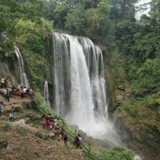
Pulhapanzak
19.3 km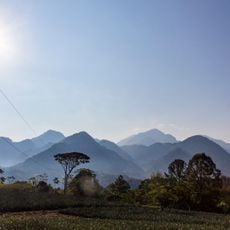
Cerro Azul Meámbar National Park
9.5 km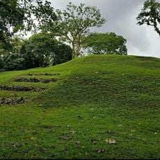
Los Naranjos
10.7 km
Montaña Santa Bárbara National Park
17.5 km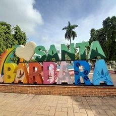
Santa Bárbara Central Park
28.2 km
Área de Uso Múltiple Lago de Yojoa
5.1 km
Cuevas de Taulabé
18.6 km
Joya Grande
20.6 km
Escultura 3
32.4 km
Lake View
10.6 km
Ruins: Structure 1 and Stelae
11 km
Start of hike to 2nd highest summit in Honduras
13.1 km
Escultura 2
32.4 km
Escultura 1
32.4 km
Iglesia Centroamericana Dios es Amor
28.4 km
Scenic viewpoint
10.2 km
Los Naranjos View
10.7 km
Summit of Santa Barbara
15.7 km
Mirador Indios Desnudos
12.9 km
Mirador Plaza Ceremonial
12.3 km
Bird Watching Tower
11 km
Scenic viewpoint
8.9 km
Scenic viewpoint
9.2 km
Scenic viewpoint
8.7 km
Tower, Observation tower, scenic viewpoint
8.7 km
Scenic viewpoint
13 km
Waterfall
9.3 km
Waterfall
8.5 kmReviews
Visited this place? Tap the stars to rate it and share your experience / photos with the community! Try now! You can cancel it anytime.
Discover hidden gems everywhere you go!
From secret cafés to breathtaking viewpoints, skip the crowded tourist spots and find places that match your style. Our app makes it easy with voice search, smart filtering, route optimization, and insider tips from travelers worldwide. Download now for the complete mobile experience.

A unique approach to discovering new places❞
— Le Figaro
All the places worth exploring❞
— France Info
A tailor-made excursion in just a few clicks❞
— 20 Minutes