Herher Open Woodland Sanctuary
Location: Vayots Dzor Province
Inception: 1958
Elevation above the sea: 1,800 m
GPS coordinates: 39.80740,45.52933
Latest update: November 14, 2025 14:54
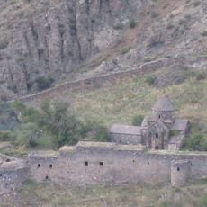
Gndevank
8.8 km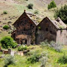
Surb Sion Monastery, Herher
3.3 km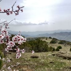
Pahakasar
6.4 km
Kanachkogh
7.6 km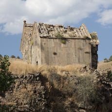
Եկեղեցի Սբ. Աստվածածին
3.3 km
Karmrak
6 km
Lenini
9.3 km
Եկեղեցի
4.5 km
P'et'ak
8.8 km
Srtin Mot
9 km
Khach'k'arach'eri Glukh
9.1 km
Masur
8 km
Averakats'
850 m
Mut' K'arayr
9.3 km
Khach'k'arach'tap'i
707 m
Ամրոց «Կապույտ»
4.2 km
Poghos-Petros Surb
996 m
Yerkrord Ashkharhamartum Zohvatsneri
3.9 km
Koshakhach'
6.5 km
Մատուռ Սբ. Գրիգոր Լուսավորիչ
4.8 km
Hot spring
9.2 km
Vayots Sar
2.7 km
Hot spring
9.2 km
Հերհերի ջրվեժ
1 km
Ruins
1.7 km
Գնդեվան ամրոց
7.4 km
Monument
9.2 km
Հերհերի ջրվեժ
1 kmReviews
Visited this place? Tap the stars to rate it and share your experience / photos with the community! Try now! You can cancel it anytime.
Discover hidden gems everywhere you go!
From secret cafés to breathtaking viewpoints, skip the crowded tourist spots and find places that match your style. Our app makes it easy with voice search, smart filtering, route optimization, and insider tips from travelers worldwide. Download now for the complete mobile experience.

A unique approach to discovering new places❞
— Le Figaro
All the places worth exploring❞
— France Info
A tailor-made excursion in just a few clicks❞
— 20 Minutes