Leongatha South, locality in Victoria, Australia
Location: Victoria
Location: South Gippsland Shire
Shares border with: Nerrena, Pound Creek, Middle Tarwin, Koonwarra, Tarwin, Leongatha, Inverloch, Outtrim, Korumburra South
GPS coordinates: -38.56523,145.70350
Latest update: November 22, 2025 11:20
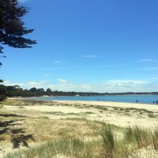
Anderson Inlet
10.3 km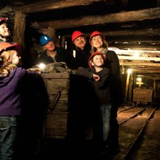
State Coal Mine Cafe
11.3 km
Rotary Centenary Park
8.4 km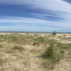
Bass Coast
9 km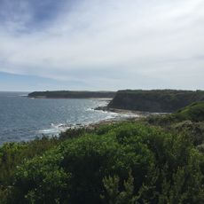
Coastline
12.1 km
Heath Mound
11.5 km
Wonthaggi State Coal Mine Northern Precinct (19 & 20 Shafts)
11.6 km
Wonthaggi Court House
11 km
Wonthaggi State Coal Mine Central Precinct
12 km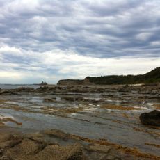
Cape Paterson cliffs
11 km
Wonthaggi State Coal Mine (Eastern Precinct)
11.4 km
Bass Coast Arts Society
10.7 km
Seam
10.4 km
Leongatha Golf Club
13.1 km
Wonthaggi Golf Club
10.8 km
Shack Bay
12.5 km
Twin Reefs
13.1 km
Eagles Nest
11.8 km
The Caves
10.8 km
Shaft
10.5 km
Locomotive K192
11.2 km
Emergence
11.7 km
Wonthaggi Visitor Information Centre
10.5 km
Scenic viewpoint
13.1 km
Eagles Nest
12 km
Wonthaggi Coal Mine Whistle
10.7 km
Wonthaggi War Memorial
10.9 km
Former engine shed
12.1 kmReviews
Visited this place? Tap the stars to rate it and share your experience / photos with the community! Try now! You can cancel it anytime.
Discover hidden gems everywhere you go!
From secret cafés to breathtaking viewpoints, skip the crowded tourist spots and find places that match your style. Our app makes it easy with voice search, smart filtering, route optimization, and insider tips from travelers worldwide. Download now for the complete mobile experience.

A unique approach to discovering new places❞
— Le Figaro
All the places worth exploring❞
— France Info
A tailor-made excursion in just a few clicks❞
— 20 Minutes