Freibad Alstätte
Location: Alstätte
Location: Ahaus
GPS coordinates: 52.13140,6.91106
Latest update: November 21, 2025 17:07
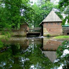
Haarmühle
2.4 km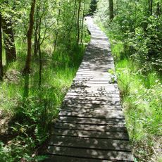
Witte Veen
3.1 km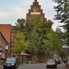
St. Mariä Himmelfahrt
427 m
Wacholderheide Hörsteloe
3.7 km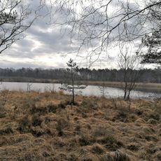
Vogelschutzgebiet 'Moore und Heiden des westlichen Münsterlandes'
2.1 km
Witte Venn
2.7 km
LSG-Alstaette - Gerwinghook
2.2 km
Bennekampshaar
3.4 km
LSG-Talaue der Alstaetter Aa
1.9 km
LSG-Luentener Feld, Ammeloer Venn
3.8 km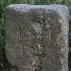
Grenspaal Hoek Twistveenweg-Weustinkhoekweg
3.6 km
Wacholderheide Hörsteloe
3.8 km
Schmaeinghook, Hörsteloe
3.4 km
Golf- und Landclub Ahaus e.V.
2.3 km
Grabstätte Reitpferd Thea
3.3 km
Wildgehege
506 m
Work of art, sculpture
427 m
Work of art, statue
426 m
Scenic viewpoint
1.1 km
Scenic viewpoint
3.3 km
Schaapskooi
3.2 km
Muttertrauer über die Opfer zweier Weltkriege
284 m
Fountain, monument
449 m
Memorial
377 m
Wayside shrine, Christianity
3.4 km
Memorial, war memorial
3.4 km
Catholic church building, wayside cross, Christianity
343 m
Catholic church building, wayside shrine, Christianity
1.8 kmReviews
Visited this place? Tap the stars to rate it and share your experience / photos with the community! Try now! You can cancel it anytime.
Discover hidden gems everywhere you go!
From secret cafés to breathtaking viewpoints, skip the crowded tourist spots and find places that match your style. Our app makes it easy with voice search, smart filtering, route optimization, and insider tips from travelers worldwide. Download now for the complete mobile experience.

A unique approach to discovering new places❞
— Le Figaro
All the places worth exploring❞
— France Info
A tailor-made excursion in just a few clicks❞
— 20 Minutes