Freibad Idarwald
Location: Rhaunen
Operator: Verbandsgemeinde Herrstein-Rhaunen
Phone: +4965449053
GPS coordinates: 49.86100,7.32321
Latest update: November 20, 2025 01:07
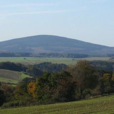
Idarkopf
3.8 km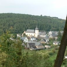
Protestant Church (Hausen Hunsrueck)
3.8 km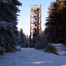
Idarkopf tower until 2022
3.8 km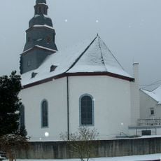
Protestant Church (Stipshausen)
2.6 km
Protestant Church (Rhaunen)
1.7 km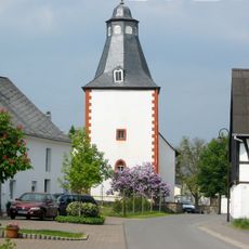
Protestant Church (Sulzbach, Hunsrueck)
3.2 km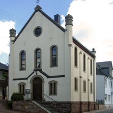
Synagoge Laufersweiler
4.2 km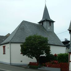
Protestant Church (Bollenbach)
3 km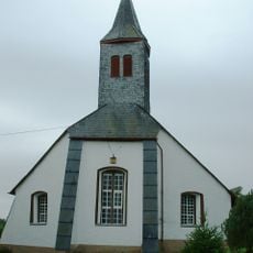
Protestant Church
4.4 km
St. Nikolaus
4.4 km
Herrenort
2.5 km
Idarkopfturm
3.8 km
Schutzhütte Wartenberg
2.2 km
Wartenberg
2.2 km
Bachspautzer
1.7 km
Scenic viewpoint
4.1 km
Scenic viewpoint
2.2 km
Scenic viewpoint
2 km
Bench, scenic viewpoint
3 km
Idarkopfturm
3.8 km
Scenic viewpoint
2.2 km
Wayside cross
3.4 km
Wayside cross
4.4 km
Catholic church building, wayside shrine, Christianity
4.4 km
Simon Meyer
2.6 km
Wayside cross
4.1 km
Catholic church building, wayside cross, Christianity
3.5 km
Catholic church building, wayside cross, Christianity
2.6 kmReviews
Visited this place? Tap the stars to rate it and share your experience / photos with the community! Try now! You can cancel it anytime.
Discover hidden gems everywhere you go!
From secret cafés to breathtaking viewpoints, skip the crowded tourist spots and find places that match your style. Our app makes it easy with voice search, smart filtering, route optimization, and insider tips from travelers worldwide. Download now for the complete mobile experience.

A unique approach to discovering new places❞
— Le Figaro
All the places worth exploring❞
— France Info
A tailor-made excursion in just a few clicks❞
— 20 Minutes