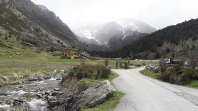
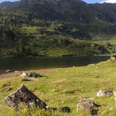
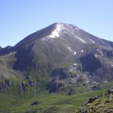
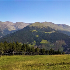
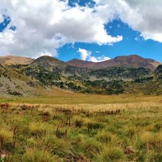
Vall d'Incles, Mountain river and hiking trail in Canillo, Andorra.
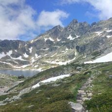
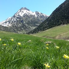
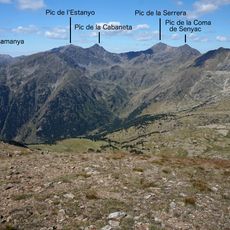
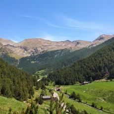
Vall d'Incles is a glacial valley with a river flowing alongside a marked hiking trail through meadows and rocky granite slopes. Along the route, open grasslands alternate with stone-covered mountainsides and lead toward higher elevations.
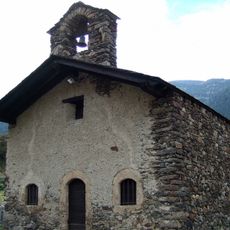
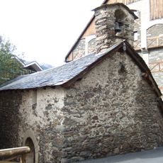
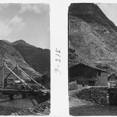
The paths formed in medieval times as trade routes connecting Andorra and France, linking mountain communities across the Pyrenees. These old routes remain in use today, showing how important the valley was for people long ago.
Local herders use the valley's meadows for their flocks following practices that go back generations, something visible as you walk through the landscape. This way of working shapes how the meadows look and how nature is used here.
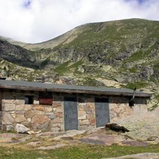
The trail is best accessible from June to October when conditions are stable and snow has melted. The Mountain Hostel Tarter provides lodging and detailed maps to help plan your hike.
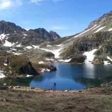
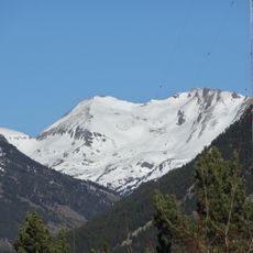
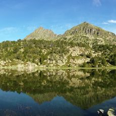
Multiple ecosystems exist within a short distance, ranging from riverside plants to alpine meadows and mountain lakes at higher elevations. This quick shift lets hikers experience different landscape types and plant communities during a single walk.
Address: Ctra. de la Vall d'Incles, AD100 Canillo, AD100, Andorra
GPS coordinates: 42.60152,1.69776
Latest update: December 6, 2025 17:50
Andorra holds a mix of old and new buildings that tell the story of life in these Pyrenees mountains. You will find medieval churches built in the Romanesque style, like Sant Esteve Church with its simple stone walls and bell tower, standing alongside 16th-century houses like Casa de la Vall that...
Grandvalira
6.6 km
Tibetan bridge in Canillo
7.4 km
Grans Magatzems Pyrénées
7 km
Étangs de Fontargente
3.1 km
Església de Sant Pere del Tarter
4.5 km
Étang de Comte
8.5 km
Església de Sant Bartomeu de Soldeu
3.7 km
Pic de Serrère
8.2 km
Pic d'Escobes
3.2 km
Alt de Juclar
1.1 km
Sant Jaume de Ransol
5.3 km
Refugi de Coms de Jan
5.2 km
Cap de la Tosa d'Entor
3.7 km
Pradarrodó
4.4 km
Tossal de la Llosada
7.2 km
Pics de la Portaneille
3.4 km
Pic de l'Estany Mort
6.3 km
Pic de Ransol
4.6 km
Pic de Torradella
6.1 km
Pic Baix del Cubil
8.1 km
Pic dels Maians
7.9 km
Pic d'Encampadana
7.2 km
Pic del Siscaró
2.3 km
Cilindre d'Escobes
2.9 km
Cap de la Cometa del Forn
4.7 km
Ribaescorjada
5.9 km
Emissora de Sud-Ràdio
7.6 km
El Siscaró
1.6 kmVisited this place? Tap the stars to rate it and share your experience / photos with the community! Try now! You can cancel it anytime.
Discover hidden gems everywhere you go!
From secret cafés to breathtaking viewpoints, skip the crowded tourist spots and find places that match your style. Our app makes it easy with voice search, smart filtering, route optimization, and insider tips from travelers worldwide. Download now for the complete mobile experience.
A unique approach to discovering new places❞
— Le Figaro
All the places worth exploring❞
— France Info
A tailor-made excursion in just a few clicks❞
— 20 Minutes