Draaikrans
Location: Baviaans Local Municipality
GPS coordinates: -33.28054,24.38114
Latest update: November 20, 2025 22:54
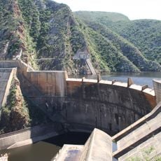
Kouga Dam
54.8 km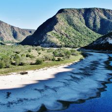
Baviaanskloof Mega Reserve
33.6 km
Kromme Dam
80.9 km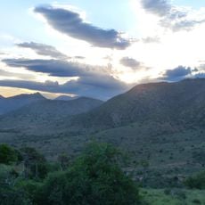
Haaspoort Game Reserve
34.7 km
Kromme Dam Reservoir
79.7 km
Bobbejaankrans
76.2 km
Rooikrans
74.5 km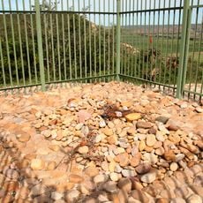
Sarah Bartmann Gravesite
77.6 km
Blaauwbosch Game Farm
45.2 km
Ouberg
67.3 km
Old Steam Train
29.3 km
Scenic viewpoint
54.7 km
Valley of Flags, Noorspoort pass
3.8 km
Dooringkloof Bushman Paintings
46.5 km
Lake Mentz
72.2 km
Bergvenster
74.1 km
Lady De Waal Bridge
5.7 km
Scenic viewpoint
39.4 km
Abseil Viewpoint
70 km
William Phillip Tunnel
74.2 km
Sarah Baartman Memorial
77.6 km
Memorial
64.6 km
Jansenville War Memorial
45.8 km
Fort Jansenville
46.5 km
Memorial
6.3 km
Memorial, commemorative plaque
54.8 km
Memorial
77.6 km
Cedar Falls
71.3 kmReviews
Visited this place? Tap the stars to rate it and share your experience / photos with the community! Try now! You can cancel it anytime.
Discover hidden gems everywhere you go!
From secret cafés to breathtaking viewpoints, skip the crowded tourist spots and find places that match your style. Our app makes it easy with voice search, smart filtering, route optimization, and insider tips from travelers worldwide. Download now for the complete mobile experience.

A unique approach to discovering new places❞
— Le Figaro
All the places worth exploring❞
— France Info
A tailor-made excursion in just a few clicks❞
— 20 Minutes