樊梨花
Location: 松潘县 ཟུང་ཆུ་རྫོང།
GPS coordinates: 32.29921,103.72539
Latest update: November 13, 2025 05:23
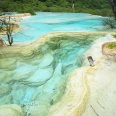
Huanglong
48.5 km
松潘古城墙
39.4 km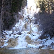
Munigou
35.4 km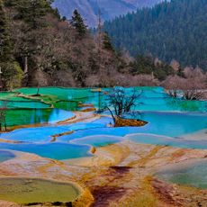
Huanglong Valley
47.1 km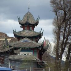
Songpan North mosque
40.3 km
Yousuotun mosque
45.3 km
Statue, Work of art
29.1 km
疊溪海子
26.3 km
Erdaohai Scenic Area of Mouni Valley
45.5 km
Zhaga Waterfall
36.5 km
Zhaga Falls Scenic Area of Mouni Valley
36.3 km
四川省茂县叠溪松坪沟省级地质公园
29.1 km
Work of art, sculpture
28.9 km
Statue, Work of art
29.1 km
West Gate
40.5 km
Scenic viewpoint
48.5 km
Scenic viewpoint
48.5 km
Guanyin temple
39.7 km
叠溪地震遗址观景点
28.7 km
Scenic viewpoint
26 km
Scenic viewpoint
25.8 km
Scenic viewpoint
41.7 km
羌族调楼
29.3 km
叠溪古城遗址
30.4 km
City gate
39.4 km
Monument
48.9 km
扎嘎瀑布
36.6 km
Waterfall
48.7 kmReviews
Visited this place? Tap the stars to rate it and share your experience / photos with the community! Try now! You can cancel it anytime.
Discover hidden gems everywhere you go!
From secret cafés to breathtaking viewpoints, skip the crowded tourist spots and find places that match your style. Our app makes it easy with voice search, smart filtering, route optimization, and insider tips from travelers worldwide. Download now for the complete mobile experience.

A unique approach to discovering new places❞
— Le Figaro
All the places worth exploring❞
— France Info
A tailor-made excursion in just a few clicks❞
— 20 Minutes