อ.รัชฏะ พลหาญ
Location: จังหวัดเชียงใหม่
GPS coordinates: 19.07951,99.17815
Latest update: November 15, 2025 02:37

Wat Mae Pang
14.8 km
Mae Ta Khrai National Park
14.3 km
Wat Doi Thaen Phra Pha Luang
18.8 km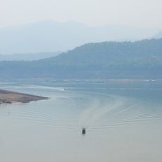
Mae Ngat Sombunchon Reservoir
14.3 km
Khuean Mae Kuang Reservoir
16.2 km
Ang Kep Nam Mae Phaeng
19 km
Red Sand
10.4 km
Statue, Work of art
19.1 km
Ban Pong Kum Hot Spring
19 km
ผาลาด
4.6 km
King of Flight Chiang Mai
11.3 km
Rabbit Crew Farm & Cafe
19.5 km
Chiang Mai Tubing
19.6 km
Bat Cave
10.3 km
Bua Tong Sticky Waterfall
10.5 km
Jungle Flight
18.8 km
Mindful farm
19.2 km
Si Lanna National Park
18.8 km
Scenic viewpoint
18.4 km
Scenic viewpoint
19.5 km
Pan-Din-Vid Viewpoint
12.2 km
Scenic viewpoint
17.2 km
Scenic viewpoint
790 m
Scenic viewpoint
1.9 km
Scenic viewpoint
2.2 km
Scenic viewpoint
16.3 km
ศาลแท่นดอกไม้
10.4 km
น้ำตกวังทอง
10.3 kmReviews
Visited this place? Tap the stars to rate it and share your experience / photos with the community! Try now! You can cancel it anytime.
Discover hidden gems everywhere you go!
From secret cafés to breathtaking viewpoints, skip the crowded tourist spots and find places that match your style. Our app makes it easy with voice search, smart filtering, route optimization, and insider tips from travelers worldwide. Download now for the complete mobile experience.

A unique approach to discovering new places❞
— Le Figaro
All the places worth exploring❞
— France Info
A tailor-made excursion in just a few clicks❞
— 20 Minutes