Ringer Trade-Mark
Location: Hay
Location: Hay Shire Council
GPS coordinates: -34.51138,144.84297
Latest update: November 21, 2025 21:23
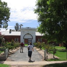
Hay Gaol
838 m
Oolambeyan National Park
46.2 km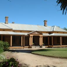
Bishops Lodge
998 m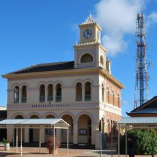
Hay Post Office
211 m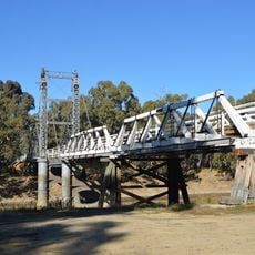
Carrathool Bridge over Murrumbidgee River
53.2 km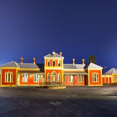
Hay Railway Station
1.3 km
Kalyarr National Park
52.7 km
Booligal Recreation Reserve
71.8 km
Halse Park
812 m
Peppin Park
77.8 km
Hay Apex Park
1.2 km
Sunset Reserve
15.8 km
Pocock Park
704 m
Booligal Gymkhana Reserve
71.7 km
Camerons Weir
84 km
Maude Weir
50 km
Hay Weir
13 km
Hay State Forest
892 m
Pinkers Beach
54.4 km
Seat?
508 m
Cobb & Co Coach Museum
309 m
Long Paddock Visitor Site - 16 Mile Gums
26 km
Long Paddock
60.7 km
Hay Outback Information Centre
339 m
Peppin Ram Memorial
78.7 km
One Tree Hotel
37.4 km
Memorial
52.9 km
Memorial
35.4 kmReviews
Visited this place? Tap the stars to rate it and share your experience / photos with the community! Try now! You can cancel it anytime.
Discover hidden gems everywhere you go!
From secret cafés to breathtaking viewpoints, skip the crowded tourist spots and find places that match your style. Our app makes it easy with voice search, smart filtering, route optimization, and insider tips from travelers worldwide. Download now for the complete mobile experience.

A unique approach to discovering new places❞
— Le Figaro
All the places worth exploring❞
— France Info
A tailor-made excursion in just a few clicks❞
— 20 Minutes