The Watcher
Location: Keilor East
Location: Melbourne
Made from material: steel
GPS coordinates: -37.73715,144.87537
Latest update: November 22, 2025 15:19
Defence Explosive Factory Maribyrnong
3 km
Knights Stadium
3.8 km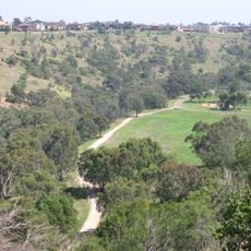
Brimbank Park
3.4 km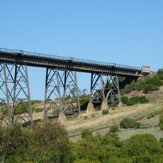
Maribyrnong River Viaduct
2.9 km
Keilor Botanic Gardens
3.1 km
Essendon Airport Air Traffic Control Tower
2.5 km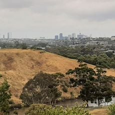
Afton Street Conservation Reserve
2.4 km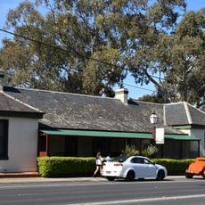
Keilor Hotel
3.9 km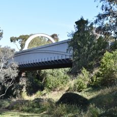
Old Iron Bridge, Keilor
3.4 km
Woodlands Park
3.5 km
Caroline Chisholm Park
3.7 km
Ian J Mcwilliams Park
1.9 km
Former Royal Australian Field Artillery Barracks
4 km
2 Riverview Road Essendon
4.2 km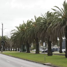
Avenue of palms, Mount Alexander Road
3.9 km
Former Clydebank
3 km
Essendon Incinerator Complex
3.9 km
Maribyrnong Tram Substation
3.8 km
Former Essendon High School
3.1 km
Gnome Village
2.7 km
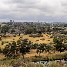
Scenic viewpoint
2.1 km
Valley Lake Lookout
109 m
Scenic viewpoint
2.2 km
Scenic viewpoint
2.5 km
Scenic viewpoint
2.4 km
Memorial
2.1 km
Commemorative plaque, memorial
3.2 km
Dodds
2.8 kmReviews
Visited this place? Tap the stars to rate it and share your experience / photos with the community! Try now! You can cancel it anytime.
Discover hidden gems everywhere you go!
From secret cafés to breathtaking viewpoints, skip the crowded tourist spots and find places that match your style. Our app makes it easy with voice search, smart filtering, route optimization, and insider tips from travelers worldwide. Download now for the complete mobile experience.

A unique approach to discovering new places❞
— Le Figaro
All the places worth exploring❞
— France Info
A tailor-made excursion in just a few clicks❞
— 20 Minutes