Local
Location: Mount Barker
Location: Mount Barker District Council
GPS coordinates: -35.07196,138.88650
Latest update: November 10, 2025 10:13
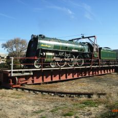
SteamRanger Heritage Railway
2 km
Mount Barker
3.2 km
Bonython Hill
6.3 km
Pioneer Park
8.7 km
Totness National Park
4.7 km
Weld Park
1.6 km
Dunn Park Oval
2.7 km
Philcox Hill
5.8 km
Miels Park
3.3 km
Willow Park
3.5 km
Keith Stephenson Park
2.8 km
Alan Bell Park
790 m
Mount Barker Tourist Park
2.6 km
Birks Hill
7.4 km
Liebelts Hill
6.1 km
Historic Windmill
5.5 km
Mt Barker-Hahndorf Golf Club
624 m
Hahndorf Old Village
8.2 km
Elder
14 m
Tracks of Tjirbruki
21 m
Tear Drops
19 m
Time
9 m
Home
9 m
Work of art, sculpture
2.7 km
Work of art, sculpture
447 m
Scenic viewpoint
138 m
Scenic viewpoint
3.2 km
Scenic viewpoint
552 mReviews
Visited this place? Tap the stars to rate it and share your experience / photos with the community! Try now! You can cancel it anytime.
Discover hidden gems everywhere you go!
From secret cafés to breathtaking viewpoints, skip the crowded tourist spots and find places that match your style. Our app makes it easy with voice search, smart filtering, route optimization, and insider tips from travelers worldwide. Download now for the complete mobile experience.

A unique approach to discovering new places❞
— Le Figaro
All the places worth exploring❞
— France Info
A tailor-made excursion in just a few clicks❞
— 20 Minutes