Chest opened
+${chestReward.xp} XP
Explorer
NOUVEAU ×${chestReward.collectible.quantity}
tapez pour fermer
Chest locked

Open chests in the app

Around Us is built for your phone — chests unlock when you walk, explore and capture nearby places.

Enable Location

We need your location to show you interesting places around you

Discover nearby places

Find interesting locations and hidden gems around you

Precise directions

Get accurate directions and distances to places

Your location is never shared with other users. It's only used when you tap the location button.

Mount Barker

Log in to your account

Start exploring — it's free

Trusted by 72,887 travelers worldwide

Continue with Google
Continue with Apple
or

We will send you a code to connect

By continuing, you accept our Terms and Conditions and our Privacy Policy

Check your inbox

We've sent a pincode in your inbox. Please enter the code below.

Mount Barker
Discussion Reviews 1 Photos
24.7k Popularity

Mount Barker, Regional administrative center in Mount Barker District Council, South Australia.

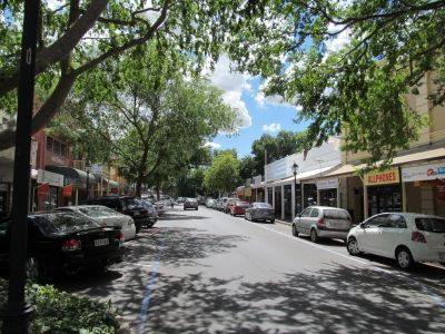
Mount Barker is a regional administrative town in South Australia serving as the main government hub for the Adelaide Hills area. It sits roughly 33 kilometers from Adelaide and provides local services and facilities to its residents across multiple neighborhoods.

The settlement began in the 1830s when Captain Charles Sturt explored the location and brought it to the attention of King William IV. This early recognition set the stage for the area's development before South Australia was formally established.

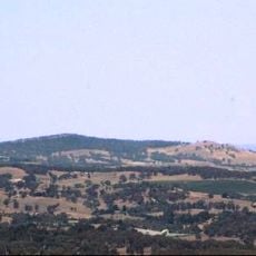
The Mount Barker Summit held deep meaning for Peramangk and Ngarrindjeri communities who gathered there for ceremonies and spiritual practices. This connection between the land and the people remains central to how the area is understood today.

Visitors can find shopping areas and services spread throughout the town center, all accessible by foot or public transport. Regular connections to Adelaide make it easy to travel to the larger city and return whenever needed.

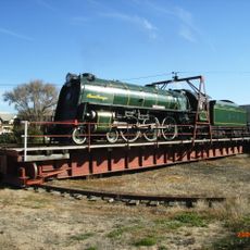
Scientist A. W. Howard discovered a type of clover in Mount Barker that transformed local farming and soil fertility in fundamental ways. This finding had major impacts on farms across the region and beyond.

The community of curious travelers

AroundUs brings together thousands of curated places, local tips, and hidden gems, enriched daily by 60,000 contributors worldwide.

Start exploring
Location
Inception
1839
Elevation above the sea
322 m
Shares border with
Nairne, Blakiston, Bugle Ranges, Wistow, Echunga, Mount Barker Springs, Mount Barker Summit, Paechtown, Hahndorf, Totness, Littlehampton
GPS coordinates
-35.06670,138.85000
Latest update
December 20, 2025 12:11
Reviews
Share your experience

No review yet

Discussions
Start a discussion...

No discussion yet

« Mount Barker - Regional administrative center in Mount Barker District Council, South Australia » is provided by Around Us (aroundus.com). Images and texts are derived from Wikimedia project under a Creative Commons license. You are allowed to copy, distribute, and modify copies of this page, under the conditions set by the license, as long as this note is clearly visible.

Discover hidden gems everywhere you go!

From secret cafés to breathtaking viewpoints, skip the crowded tourist spots and find places that match your style. Our app makes it easy with voice search, smart filtering, route optimization, and insider tips from travelers worldwide. Download now for the complete mobile experience.

Around Us App Screenshot

A unique approach to discovering new places

Le Figaro

All the places worth exploring

France Info

A tailor-made excursion in just a few clicks

20 Minutes

Around Us
Travel Guide & Maps
Download

Send to your phone

QR Code
1

Open the camera app on your mobile.

2

Point at the QR code with your camera. A notification will appear.

3

Tap the notification to open the link.