Le ciel enfantin
Location: Colmars
Inception: January 1, 1992
Creator: Kees Verkade
Made from material: metal
GPS coordinates: 44.18131,6.62827
Latest update: July 20, 2025 15:24
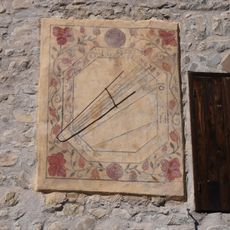
Cadran solaire de la maison communale
2.6 km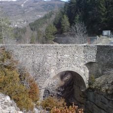
Pont Haut
657 m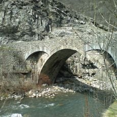
Pont Saint-Roch
382 m
Enceinte de Colmars
112 m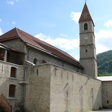
Église Saint-Martin
142 m
Maison-Musée du Haut-Verdon
118 m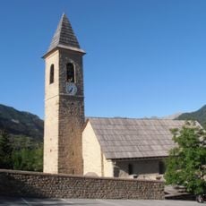
Église Saint-Sévère, Villars-Colmars
2.8 km
Roche Cline (tumoy sa bukid sa Pransiya, Département des Alpes-de-Haute-Provence)
4.3 km
Chapelle Notre-Dame-des-Grâces de Colmars
128 m
Tête des Muletiers
4.7 km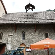
Chapelle Saint-Joseph de Colmars
131 m
Sommet de Noncière
3.8 km
Scenic viewpoint
1.7 km
Scenic viewpoint
205 m
La Colletta
982 m
Croix du Puy
3.4 km
Work of art, statue
2.2 km
Porte de France
192 m
Porte de Savoie
108 m
Scenic viewpoint
2.6 km
Porte des Gracis
100 m
Cascade de Chaumie
2.9 km
Waterfall
3.4 km
Cascade de la Lance
1.1 km
Waterfall
3.5 km
Oaratoire de St Jean
695 m
Wayside shrine
298 m
Wayside cross
212 mVisited this place? Tap the stars to rate it and share your experience / photos with the community! Try now! You can cancel it anytime.
Discover hidden gems everywhere you go!
From secret cafés to breathtaking viewpoints, skip the crowded tourist spots and find places that match your style. Our app makes it easy with voice search, smart filtering, route optimization, and insider tips from travelers worldwide. Download now for the complete mobile experience.

A unique approach to discovering new places❞
— Le Figaro
All the places worth exploring❞
— France Info
A tailor-made excursion in just a few clicks❞
— 20 Minutes