Nachtzeichen
Location: Gelsenkirchen-Nord
Location: Gelsenkirchen
Inception: January 1, 1999
Creator: Hermann EsRichter; Klaus Noculak
Creator: Hermann EsRichter; Klaus Noculak
GPS coordinates: 51.56217,7.04093
Latest update: November 24, 2025 02:03

Zeche Hugo
883 m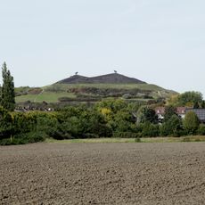
Halde Rungenberg
33 m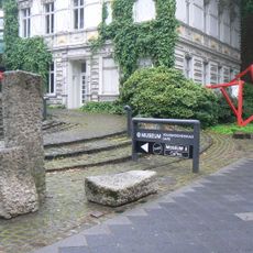
Gelsenkirchen Art Museum
1.9 km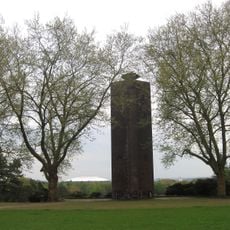
Ehrenmal Buer
1.4 km
LSG-Bauer Becks
1.3 km
Am Nattbach
1.9 km
St. Ludgerus
988 m
LSG-Berger Anlagen / Lohmuehlental
1.7 km
LSG-Huelser Heide, Schaffrath, Rungenberg
1.6 km
LSG-Sutumerfeld
1.6 km
Raumsäulen
1.6 km
Ohne Titel (Mobiles Objekt)
1.9 km
Altes Bahnwärterhäuschen Hugo-Bahn
616 m
Rolling Sun
1.8 km
Siedlung Schüngelberg
398 m
Nachtzeichen
66 m
Schienenplateau
318 m
Steinskulptur
1.9 km
Elastic Cube
1.9 km
Loren
924 m
Reservebank
1.9 km
Baumskulptur
1.9 km
Scenic viewpoint
68 m
Scenic viewpoint
3 m
Ehemaliger Friedhof Beckhausen
1.1 km
6m-Seilscheibe der Zeche Hugo (gestiftet 1985)
588 m
Kreuzkapelle
1.7 km
Backem's Krüz
1.8 kmReviews
Visited this place? Tap the stars to rate it and share your experience / photos with the community! Try now! You can cancel it anytime.
Discover hidden gems everywhere you go!
From secret cafés to breathtaking viewpoints, skip the crowded tourist spots and find places that match your style. Our app makes it easy with voice search, smart filtering, route optimization, and insider tips from travelers worldwide. Download now for the complete mobile experience.

A unique approach to discovering new places❞
— Le Figaro
All the places worth exploring❞
— France Info
A tailor-made excursion in just a few clicks❞
— 20 Minutes