Steinzeichen
Location: Carpin
Creator: Michael Flatau
Creator: Michael Flatau
GPS coordinates: 53.32859,13.24372
Latest update: October 26, 2025 13:41
Heilige Hallen
8.4 km
Altstrelitzer Gefängnis
9.7 km
Kloster Wanzka
8.7 km
Waldsee Hunting Castle
4.2 km
Technikum Strelitz
10.2 km
Serrahn Hills
2.6 km
Klapperberge
9 km
Kulowseen
7.5 km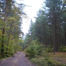
Comthureyer Berg
7.1 km
Dorfkirche Rutenberg
9.5 km
Village church Beenz (Lychen)
9.6 km
Feldberger Seenlandschaft
7.5 km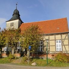
Church in Thurow
6.9 km
Klapperberge
8.7 km
Loisach valley wetlands
789 m
Wald- und Seenlandschaft Lieps-Serrahn
5.4 km
Godendorfer Mühlenbach
5.3 km
Sandergebiet südlich von Serrahn
8.1 km
Federzeichen
6 km
Feuerstelle
1.9 km
Federzeichen
4.3 km
Work of art, installation artwork
4.2 km
Großer Serrahnsee
4.1 km
Scenic viewpoint
8.3 km
Rastplatz und aussicht Champagnerinsel
5.3 km
Scenic viewpoint
7.3 km
Scenic viewpoint
7.8 km
Scenic viewpoint
6.8 kmReviews
Visited this place? Tap the stars to rate it and share your experience / photos with the community! Try now! You can cancel it anytime.
Discover hidden gems everywhere you go!
From secret cafés to breathtaking viewpoints, skip the crowded tourist spots and find places that match your style. Our app makes it easy with voice search, smart filtering, route optimization, and insider tips from travelers worldwide. Download now for the complete mobile experience.

A unique approach to discovering new places❞
— Le Figaro
All the places worth exploring❞
— France Info
A tailor-made excursion in just a few clicks❞
— 20 Minutes