Ehemaliges Cistercienser/innen Kloster / Sonnenuhr
Location: Frechen
Creator: Heinrich Tigges, Duisburg
Made from material: metal
Creator: Heinrich Tigges, Duisburg
GPS coordinates: 50.88931,6.76285
Latest update: November 20, 2025 01:23
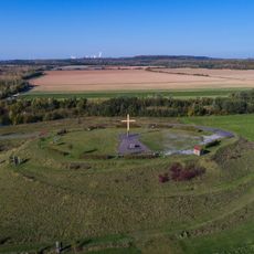
Marienfeld
1.8 km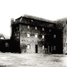
Bottenbroich Abbey
1.8 km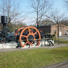
Grube Sibylla
2.4 km
Wilhelmshöhe
2.2 km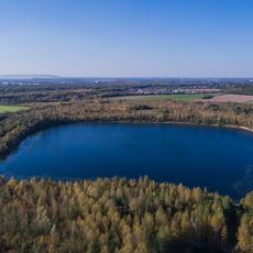
Boisdorfer See und Fürstenberggraben
2.1 km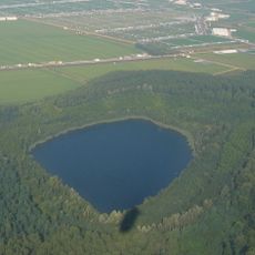
Fürstenberg-Maar
955 m
LSG-Umgebung Rosmar, Magdalenen und Sybillenhof
2.8 km
LSG-Rekultivierungsbereich Benzelrath
2.3 km
LSG-Ehemaliger Tagebau Frechen/Marienfeld
1.3 km
Ehemaliger Tagebau Frechen / Marienfel (temporär)
1.4 km
Dem Andenken unserer Krieger
2.5 km
Adolph-Kolping-Pilgerweg
2.8 km
Scenic viewpoint
1.7 km
Wayside cross
101 m
Wilhelmshöhe
2.2 km
Standort der ehemaligen Pfarrkirche St. Antonius
2.5 km
Wayside cross
2.6 km
Wayside cross
2.8 km
Wayside cross
2.4 km
Scenic viewpoint
1.3 km
Memorial
424 m
Catholic church building, wayside shrine, Christianity
1.4 km
Catholic church building, wayside cross, Christianity
2.7 km
Wayside shrine
1.3 km
Wayside shrine
1.2 km
Wayside shrine
1.3 km
Commemorative plaque, memorial
2.7 km
Grefrath vor der Umsiedlung
1.5 kmReviews
Visited this place? Tap the stars to rate it and share your experience / photos with the community! Try now! You can cancel it anytime.
Discover hidden gems everywhere you go!
From secret cafés to breathtaking viewpoints, skip the crowded tourist spots and find places that match your style. Our app makes it easy with voice search, smart filtering, route optimization, and insider tips from travelers worldwide. Download now for the complete mobile experience.

A unique approach to discovering new places❞
— Le Figaro
All the places worth exploring❞
— France Info
A tailor-made excursion in just a few clicks❞
— 20 Minutes