Lintzford
Location: Newcastle upon Tyne
Inception: January 1, 1990
Creator: Nick Lloyd
Creator: Nick Lloyd
GPS coordinates: 54.96101,-1.64338
Latest update: November 15, 2025 14:34
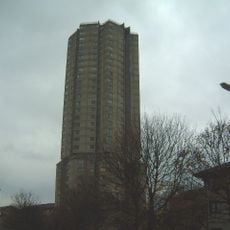
Derwent Tower
1 km
St Stephen's Church, Low Elswick
347 m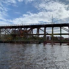
Dunston staiths
723 m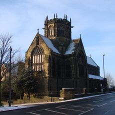
Church of St Michael And Presbytery Attached
565 m
St John's Cemetery North Entrance Gates, Piers, Walls And Railings
943 m
Lodges To St John's Cemetery North Entrance
931 m
Chapels And Archway In St John's Cemetery
799 m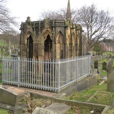
Mather Tomb In St John's Cemetery
837 m
Elswick Lodge And Wall Attached
990 m
Conrad House And Western House
1.2 km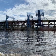
River Tyne Dunston Coal Staithes
732 m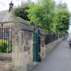
Railings And Walls To South And East Of Hospital Of St Mary The Virgin Almshouses
1.2 km
Hospital Of St Mary The Virgin Almshouses
1.2 km
White Gate
536 m
Piers, Walls, Gates And Railings In Front Of Elswick Lodge
977 m
1-3, Bentinck Place
1.1 km
Former Parish School
459 m
Walls, Gate Piers, Gates And Railngs Around Church And Presbytery Of St Michael
574 m
Ashfield Parents Centre And Ashfield Nursery School And Walls, Gate Piers And Gate Attached
1 km
Wyclif Baptist Church
843 m
80-88, Elswick Road
1.1 km
Adelaide Picture Hall
1.1 km
Imperial Cinema
666 m
Spheres
524 m
Spheres
667 m
Spheres
380 m
Spheres
371 m
Work of art, sculpture
1.2 kmReviews
Visited this place? Tap the stars to rate it and share your experience / photos with the community! Try now! You can cancel it anytime.
Discover hidden gems everywhere you go!
From secret cafés to breathtaking viewpoints, skip the crowded tourist spots and find places that match your style. Our app makes it easy with voice search, smart filtering, route optimization, and insider tips from travelers worldwide. Download now for the complete mobile experience.

A unique approach to discovering new places❞
— Le Figaro
All the places worth exploring❞
— France Info
A tailor-made excursion in just a few clicks❞
— 20 Minutes