XII
Location: Remetské Hámre
Location: okres Sobrance
GPS coordinates: 48.86428,22.17459
Latest update: July 20, 2025 19:59
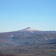
Vihorlat
5.4 km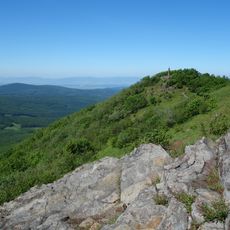
Vihorlat
5.2 km
Lysák
2.1 km
Motrogon
5.1 km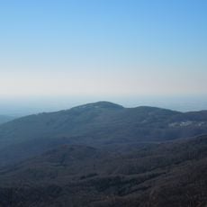
Lysák
2.1 km
Machnaty vrch
2.1 km
Baba pod Vihorlatom
4.8 km
Pod Tŕstím
3.3 km
Súbor zotavovní, vila
2.3 km
Lomok
2.1 km
Chrám sv. Michala Archanjela
4.2 km
VII
377 m
VI
409 m
Waterfall
1.8 km
Scenic viewpoint
1.9 km
Scenic viewpoint
2 km
II
577 m
III
533 m
IV
479 m
V
441 m
I
601 m
VIII
286 m
IX
195 m
XIV
189 m
Scenic viewpoint
4.9 km
X
131 m
XIII
120 m
Scenic viewpoint
5.3 kmReviews
Visited this place? Tap the stars to rate it and share your experience / photos with the community! Try now! You can cancel it anytime.
Discover hidden gems everywhere you go!
From secret cafés to breathtaking viewpoints, skip the crowded tourist spots and find places that match your style. Our app makes it easy with voice search, smart filtering, route optimization, and insider tips from travelers worldwide. Download now for the complete mobile experience.

A unique approach to discovering new places❞
— Le Figaro
All the places worth exploring❞
— France Info
A tailor-made excursion in just a few clicks❞
— 20 Minutes