Musical Highway
Location: Bernalillo County
Creator: Route 66
Creator: Route 66
GPS coordinates: 35.07267,-106.41520
Latest update: November 12, 2025 01:01
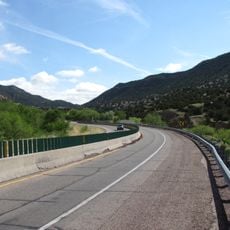
Tijeras Canyon
2.7 km
Hinkle Family Fun Center
8.1 km
Gutierrez Canyon Open Space
9 km
Shawshaw Park
8.6 km
Northeast Albuquerque
9.1 km
Work of art, sculpture
7.4 km
Scenic viewpoint
9.4 km
Sandia Helitack
3.2 km
PGM-11 Redstone Rocket
10.8 km
Council Ring - Outdoor Classroom
2.2 km
Aluminum Yucca
5.9 km
Eye Of The Sandias
4.7 km
Luis Garcia
2.4 km
66
7.9 km
Four Hills Golf Course
7.8 km
Osos del Cañon
10.7 km
RIM-2 Terrier
10.8 km
Scenic viewpoint
5.7 km
Scenic viewpoint
8.7 km
Scenic viewpoint
8.9 km
Lightning Scarred Tree
3.6 km
Scenic viewpoint
8.7 km
Scenic viewpoint
5.5 km
Scenic viewpoint
5 km
Scenic viewpoint
5.4 km
Travertine Falls
3.2 km
Waterfall
8.3 km
Waterfall
9.5 kmReviews
Visited this place? Tap the stars to rate it and share your experience / photos with the community! Try now! You can cancel it anytime.
Discover hidden gems everywhere you go!
From secret cafés to breathtaking viewpoints, skip the crowded tourist spots and find places that match your style. Our app makes it easy with voice search, smart filtering, route optimization, and insider tips from travelers worldwide. Download now for the complete mobile experience.

A unique approach to discovering new places❞
— Le Figaro
All the places worth exploring❞
— France Info
A tailor-made excursion in just a few clicks❞
— 20 Minutes