גב חלון
Location: מועצה אזורית תמר
Website: http://www.nelech.co.il/%D7%9E%D7%A1%D7%9C%D7%95%D7%9C%D7%99%D7%9D/%D7%9E%D7%99%D7%93%D7%A2/%D7%92%D7%91-%D7%94%D7%97%D7%9C%D7%95%D7%9F-%D7%95%D7%9E%D7%A2%D7%A8%D7%AA-%D7%93%D7%95%D7%93%D7%99%D7%9D
GPS coordinates: 31.47154,35.38451
Latest update: November 11, 2025 16:11
Ein Gedi
1.1 km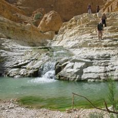
Arugot Stream
1.8 km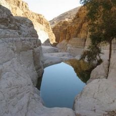
David Stream
304 m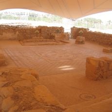
Ein Gedi synagogue
1.4 km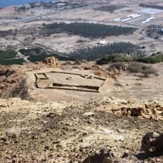
Chalcolithic Temple of Ein Gedi
599 m
Me‘arat HaBerekha
914 m
Me‘arat Dodim
345 m
Shemurat ‘En Gedi
1.2 km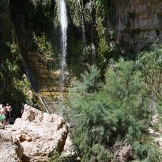
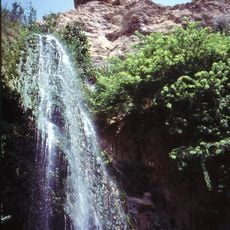
David Waterfall
405 m
Scenic viewpoint
976 m
תל גורן
1.3 km
Scenic viewpoint
1.5 km
מצפה עין גדי
975 m
Scenic viewpoint
747 m
Chalcolithic Temple
503 m
מצד ערוגות
1.4 km
Ruins
668 m
Ruins
780 m
Ancient Synagogue
1.3 km
תחנת קמח
683 m
עפיפון עין גדי
1 km
Waterfall
1.3 km
המפל התחתון
742 m
Waterfall
545 m
Waterfall
13 m
Waterfall
450 m
מפל נחל ישי
1.5 km
Waterfall
1.8 kmReviews
Visited this place? Tap the stars to rate it and share your experience / photos with the community! Try now! You can cancel it anytime.
Discover hidden gems everywhere you go!
From secret cafés to breathtaking viewpoints, skip the crowded tourist spots and find places that match your style. Our app makes it easy with voice search, smart filtering, route optimization, and insider tips from travelers worldwide. Download now for the complete mobile experience.

A unique approach to discovering new places❞
— Le Figaro
All the places worth exploring❞
— France Info
A tailor-made excursion in just a few clicks❞
— 20 Minutes