
Scenic viewpoint
Location: מועצה אזורית מעלה יוסף
GPS coordinates: 33.04799,35.22740
Latest update: November 12, 2025 19:26
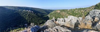
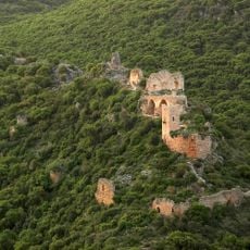
Montfort Castle
411 m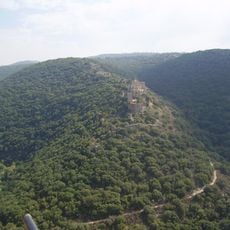
Goren Park
591 m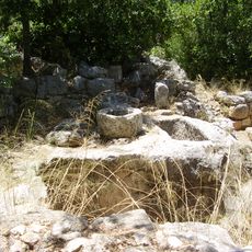
Hirbet Danila
2.7 km
Davidson Garden
2 km
Horvat Galil
2 km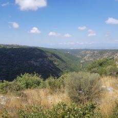
תצפית ובור עתיק
1.6 km
Me‘arat Goren
640 m
תצפית יפה ואינטימית
142 m
Shemurat H̱orbat Bilton
2.1 km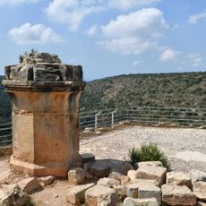
Scenic viewpoint
399 m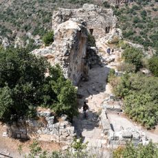
Scenic viewpoint
437 m
Scenic viewpoint
768 m
חורבת בית אוריה
2.1 km
תצפית על המונפור
479 m
Monfort Castle
406 m
Scenic viewpoint
415 m
שכבות גיר בנחל כזיב
1.7 km
Scenic viewpoint
1.9 km
חורבת עדרון
1.7 km
חורבת טבורית
2.6 km
Scenic viewpoint
504 m
חורבת עקודים
1.4 km
חורבת גליל
1.7 km
חורבת בילטון
1.9 km
חורבת נחת
1 km
טחנה
805 m
טחנה
727 m
בור מים גדול עם קשתות
1.4 kmReviews
Visited this place? Tap the stars to rate it and share your experience / photos with the community! Try now! You can cancel it anytime.
Discover hidden gems everywhere you go!
From secret cafés to breathtaking viewpoints, skip the crowded tourist spots and find places that match your style. Our app makes it easy with voice search, smart filtering, route optimization, and insider tips from travelers worldwide. Download now for the complete mobile experience.

A unique approach to discovering new places❞
— Le Figaro
All the places worth exploring❞
— France Info
A tailor-made excursion in just a few clicks❞
— 20 Minutes