
כביש הגישה מסומן באבנים, לא בצבע
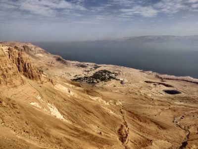
Location: מועצה אזורית תמר
GPS coordinates: 31.43986,35.36775
Latest update: November 11, 2025 20:19
Cave of Letters
2.5 km
Ein Gedi synagogue
3.4 km
Ein Gedi Spa
2.7 km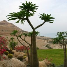
Ein Gedi Botanical Gardens
1.9 km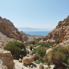
Ein Gedi Eco Park
2.2 km
H̱ammé Mazor
2.5 km
H̱ammé Yesha‘
2.9 km
Shemurat ‘En Gedi
2.7 km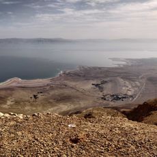
כביש גישה מסומן באבנים, לא בצבע
1.3 km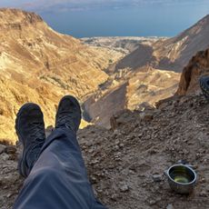
ראש מעלה איסיים
1.8 km
Arugot Viewpoint
2.9 km
תל גורן
3 km
Scenic viewpoint
2.5 km
Scenic viewpoint
2.1 km
Botanic Garden
2 km
Scenic viewpoint
3.1 km
Scenic viewpoint
2.3 km
Nubian Ibex (Wild)
2.1 km
מצד ערוגות
2.6 km
מצפה עין גדי
2.9 km
קבר לוחמי בר כוכבא
2 km
Archaeological site
3.1 km
Waterfall
2.4 km
המפל הנסתר
2 km
מפלון
2 km
Waterfall
1.5 km
Waterfall
1.2 km
Waterfall
2.9 kmReviews
Visited this place? Tap the stars to rate it and share your experience / photos with the community! Try now! You can cancel it anytime.
Discover hidden gems everywhere you go!
From secret cafés to breathtaking viewpoints, skip the crowded tourist spots and find places that match your style. Our app makes it easy with voice search, smart filtering, route optimization, and insider tips from travelers worldwide. Download now for the complete mobile experience.

A unique approach to discovering new places❞
— Le Figaro
All the places worth exploring❞
— France Info
A tailor-made excursion in just a few clicks❞
— 20 Minutes