
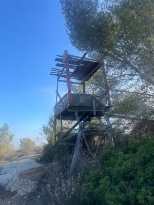
זולה
Location: מועצה אזורית מטה יהודה
GPS coordinates: 31.79681,35.03083
Latest update: October 24, 2025 18:55
Eshtaol
2.6 km
Shemurat HaMasreq
1.4 km
חאן שער הגיא
2.1 km
B'nai B'rith cave
2.1 km
Mahal memorial
1.8 km
5th Palmach Battalion Monument
2.3 km
יד אנה פרנק
2.2 km
Association of Americans and Canadians in Israel Memorial Forest
2.3 km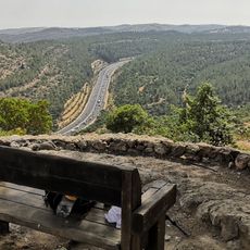
נקודת תצפית על שער הגיא עם ספסל שמשקיפה על כביש 1 ועל הרכס שמצפונו שכולל משלטים נוספים
1.3 km
Sha'ar HaGai lookout
2.3 km
Shemurat HaShayyarot
1.9 km
תצפית על שער הגיא
889 m
Me‘arat HaẔadiq
2 km
Nahal Kisalon Lookout Point
2.4 km
משלט 16
1.5 km
Scenic viewpoint
2.3 km
מצדית חרסיס
2.3 km
יד אנה פרנק
2.1 km
Khirbet Deir Abu Kabus
2.3 km
סן מרטין
1.7 km
Archaeological site
2.3 km
תצפית המסרק
858 m
הגדוד החמישי
2.3 km
משלט 21
809 m
מצפה אשתאול-אנדרטת שחף
2.5 km
גת
490 m
אבני מיל רומיות
2.7 km
Ruins
2.7 kmReviews
Visited this place? Tap the stars to rate it and share your experience / photos with the community! Try now! You can cancel it anytime.
Discover hidden gems everywhere you go!
From secret cafés to breathtaking viewpoints, skip the crowded tourist spots and find places that match your style. Our app makes it easy with voice search, smart filtering, route optimization, and insider tips from travelers worldwide. Download now for the complete mobile experience.

A unique approach to discovering new places❞
— Le Figaro
All the places worth exploring❞
— France Info
A tailor-made excursion in just a few clicks❞
— 20 Minutes