Chest opened
+${chestReward.xp} XP
Explorer
NOUVEAU ×${chestReward.collectible.quantity}
tapez pour fermer

See the monuments around you in AR Open chests in the app

Around Us is built for your phone — point your camera at the streets and discover the monuments and places around you in augmented reality. Around Us is built for your phone — chests unlock when you walk, explore and capture nearby places.

Enable Location

We need your location to show you interesting places around you

Discover nearby places

Find interesting locations and hidden gems around you

Precise directions

Get accurate directions and distances to places

Your location is never shared with other users. It's only used when you tap the location button.

Table d'orientation du puy du Vareyron

Log in to your account

Start exploring — it's free

Trusted by 83,988 travelers worldwide

Continue with Google
Continue with Apple
or

We will send you a code to connect

By continuing, you accept our Terms and Conditions and our Privacy Policy

Check your inbox

We've sent a pincode in your inbox. Please enter the code below.

Table d'orientation du puy du Vareyron
Discussion Reviews 1 Photos
10+ Popularity

Table d'orientation du puy du Vareyron, Toposcope viewpoint in Lamazière-Haute, France

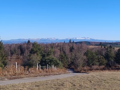
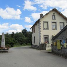
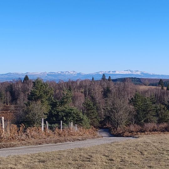
The Table d'orientation du Puy du Vareyron is a toposcope viewpoint set on the summit of the Puy du Vareyron near Lamazière-Haute, in the Corrèze department of France. The orientation table mounted there faces an open panorama of hills, forests, and scattered villages stretching toward the Monts d'Auvergne.

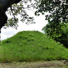
The Puy du Vareyron was a known landmark in the Corrèze countryside long before the toposcope was installed. Setting up an orientation table there followed a widespread French practice of opening high points to walkers and travelers.

The toposcope on the Puy du Vareyron displays the names of visible peaks and landmarks, helping visitors identify the hills of Limousin and the Monts d'Auvergne in the distance. Hikers use it as a natural resting point along their routes through the area around Lamazière-Haute.

The viewpoint is reached via the D21 road between Eygurande and Couffy-sur-Sarsonne, with parking available close by. Sturdy footwear is a good idea, as the path to the top can be a dirt trail that changes with the seasons.

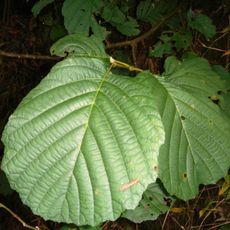
The Puy du Vareyron is surrounded by a forest of around 600 hectares mixing deciduous and coniferous trees, which gives the viewpoint a very different look depending on the season. Part of that forest was planted in 1982 and is still recognizable as you approach the summit.

The community of curious travelers

AroundUs brings together thousands of curated places, local tips, and hidden gems, enriched daily by 60,000 contributors worldwide.

Start exploring
Location
Address
19340 Lamazière-Haute, France
GPS coordinates
45.69462,2.35566
Latest update
August 6, 2026 08:42
Reviews
Share your experience

No review yet

Discussions
Start a discussion...

No discussion yet

« Table d'orientation du puy du Vareyron - Toposcope viewpoint in Lamazière-Haute, France » is provided by Around Us (aroundus.com). Images and texts are derived from Wikimedia project under a Creative Commons license. You are allowed to copy, distribute, and modify copies of this page, under the conditions set by the license, as long as this note is clearly visible.

Discover hidden gems everywhere you go!

From secret cafés to breathtaking viewpoints, skip the crowded tourist spots and find places that match your style. Our app makes it easy with voice search, smart filtering, route optimization, and insider tips from travelers worldwide. Download now for the complete mobile experience.

Around Us App Screenshot

A unique approach to discovering new places

Le Figaro

All the places worth exploring

France Info

A tailor-made excursion in just a few clicks

20 Minutes

Around Us
Travel Guide & Maps
Download

Send to your phone

QR Code
1

Open the camera app on your mobile.

2

Point at the QR code with your camera. A notification will appear.

3

Tap the notification to open the link.