Chest opened
+${chestReward.xp} XP
Explorer
NOUVEAU ×${chestReward.collectible.quantity}
tapez pour fermer
Chest locked

Open chests in the app

Around Us is built for your phone — chests unlock when you walk, explore and capture nearby places.

Enable Location

We need your location to show you interesting places around you

Discover nearby places

Find interesting locations and hidden gems around you

Precise directions

Get accurate directions and distances to places

Your location is never shared with other users. It's only used when you tap the location button.

Log in to your account

Start exploring — it's free

Trusted by 72,967 travelers worldwide

Continue with Google
Continue with Apple
or

We will send you a code to connect

By continuing, you accept our Terms and Conditions and our Privacy Policy

Check your inbox

We've sent a pincode in your inbox. Please enter the code below.

Puy des Chaires
Discussion Reviews Photo
1k Popularity

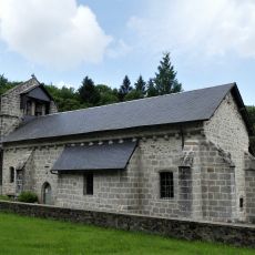
Puy des Chaires, Mountain summit in Massif Central, France.

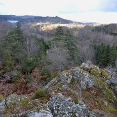
Puy des Chaires is the highest peak in Creuse department, rising to 936 meters above sea level. From this summit, hikers can see across the rolling plateaus and valleys of the Massif Central region.

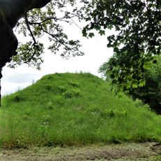
This mountain formed as part of the ancient Massif Central range through geological processes spanning millions of years. Over time, it became a defining landmark in the landscape of central France.

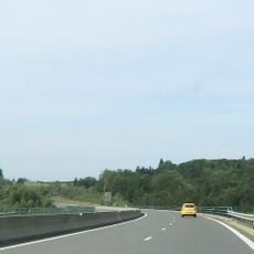
A marked hiking trail departs from Saint-Oradoux-de-Chirouze and forms a loop of about 2.8 kilometers that reaches the summit. The pathways are well-marked and suitable for hikers of varying abilities.

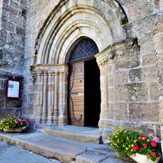
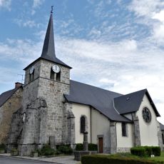
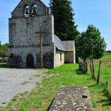
The peak sits within a regional natural park containing nearly 1000 other summits, yet most visitors overlook the specific geological features that distinguish it. Its position makes it a useful landmark for locals and hikers navigating the plateau.

The community of curious travelers

AroundUs brings together thousands of curated places, local tips, and hidden gems, enriched daily by 60,000 contributors worldwide.

Start exploring
GPS coordinates
45.71064,2.34581
Latest update
December 14, 2025 20:04
Around this place
Viaducs de la Barricade et des Bergères
France

Viaducs de la Barricade et des Bergères

13.3 km
Château de Magnat
France

Château de Magnat

10.6 km
Pont d'accès à l'aire de Chavanon
France

Pont d'accès à l'aire de Chavanon

13.4 km
Arboretum du Massif des Agriers
France

Arboretum du Massif des Agriers

2.8 km
Viaduc des Bergères
France

Viaduc des Bergères

13.3 km
France

Château du Bost

12.8 km
Saint Michael Chapel
France

Saint Michael Chapel

9.3 km
Mottes castrales de Saint-Oradoux-de-Chirouze
France

Mottes castrales de Saint-Oradoux-de-Chirouze

2.7 km
Église de l'Assomption-de-la-Très-Sainte-Vierge de Magnat-l'Étrange
France

Église de l'Assomption-de-la-Très-Sainte-Vierge de Magnat-l'Étrange

10.6 km
Église Saint-Martin de Sornac
France

Église Saint-Martin de Sornac

12.8 km
Église Saint-Pierre-ès-Liens de Courteix
France

Église Saint-Pierre-ès-Liens de Courteix

6.9 km
Roches de Murat
France

Roches de Murat

7.5 km
Église Saint-Barthélemy de Giat
France

Église Saint-Barthélemy de Giat

14 km
Église Saint-Remi de Saint-Rémy
France

Église Saint-Remi de Saint-Rémy

8.5 km
Église Saint-Aignan de Saint-Agnant-près-Crocq
France

Église Saint-Aignan de Saint-Agnant-près-Crocq

10.3 km
Église Saint-Martin de Flayat
France

Église Saint-Martin de Flayat

7.9 km
Église Saint-Clair de Feyt
France

Église Saint-Clair de Feyt

10.4 km
Église Saint-Barthélémy de Saint-Oradoux-de-Chirouze
France

Église Saint-Barthélémy de Saint-Oradoux-de-Chirouze

2.7 km
Église Saint-Médard de Saint-Merd-la-Breuille
France

Église Saint-Médard de Saint-Merd-la-Breuille

7.5 km
Église Saint-Pierre-et-Saint-Paul de Beissat
France

Église Saint-Pierre-et-Saint-Paul de Beissat

8.7 km
Église Saint-Jean-Baptiste de Malleret
France

Église Saint-Jean-Baptiste de Malleret

6.6 km
Église Saint-Pierre-et-Saint-Paul du Mas-d'Artige
France

Église Saint-Pierre-et-Saint-Paul du Mas-d'Artige

12 km
Église Sainte-Croix de Lamazière-Haute
France

Église Sainte-Croix de Lamazière-Haute

6 km
Église Saint-Martial-de-Limoges de Couffy-sur-Sarsonne
France

Église Saint-Martial-de-Limoges de Couffy-sur-Sarsonne

5.6 km
Église Saint-Pierre-ès-Liens de Laroche-près-Feyt
France

Église Saint-Pierre-ès-Liens de Laroche-près-Feyt

12.6 km
Église de l'Assomption-de-la-Très-Sainte-Vierge de La Courtine
France

Église de l'Assomption-de-la-Très-Sainte-Vierge de La Courtine

6.5 km
Église Saint-Pardoux de Saint-Pardoux-le-Neuf
France

Église Saint-Pardoux de Saint-Pardoux-le-Neuf

11.1 km
Croix de cimetière du Mas-d'Artige
France

Croix de cimetière du Mas-d'Artige

11.8 km
Show the full map
Reviews
Share your experience

No review yet

Discussions
Start a discussion...

No discussion yet

« Puy des Chaires - Mountain summit in Massif Central, France » is provided by Around Us (aroundus.com). Images and texts are derived from Wikimedia project under a Creative Commons license. You are allowed to copy, distribute, and modify copies of this page, under the conditions set by the license, as long as this note is clearly visible.

Discover hidden gems everywhere you go!

From secret cafés to breathtaking viewpoints, skip the crowded tourist spots and find places that match your style. Our app makes it easy with voice search, smart filtering, route optimization, and insider tips from travelers worldwide. Download now for the complete mobile experience.

Around Us App Screenshot

A unique approach to discovering new places

Le Figaro

All the places worth exploring

France Info

A tailor-made excursion in just a few clicks

20 Minutes

Around Us
Travel Guide & Maps
Download

Send to your phone

QR Code
1

Open the camera app on your mobile.

2

Point at the QR code with your camera. A notification will appear.

3

Tap the notification to open the link.