
Scenic viewpoint
Location: County Durham
Website: https://www.geograph.org.uk/photo/351804
Website: https://geograph.org.uk/photo/351804
GPS coordinates: 54.83645,-1.55031
Latest update: November 15, 2025 17:36

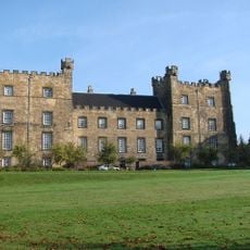
Lumley Castle
2 km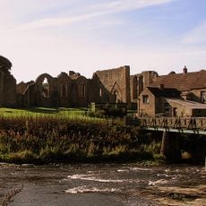
Finchale Priory
2.2 km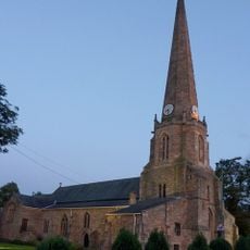
St Mary and St Cuthbert, Chester-le-Street
2.6 km
Ropery Lane
2.2 km
Lumley Park House
1.4 km
Harbour House Chapel
1.1 km
Former Chapel North Of Harbour House
1.1 km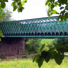
Cocken Bridge
2.1 km
Finchale Bridge
2.1 km
Settlement SW of Harbour House Farm
1.5 km
Hermitage Hospital And Attached Former Stables And Coach House
2.3 km
Harbour House
1.2 km
Piers, Walls, Gates And Railings At East Lodge, Hermitage Park
1.9 km
Ice House To North Of Morton House
2.5 km
Finchale Abbey Farmhouse
2.1 km
Barn And Gin-Gang 100 Metres South West Of Finchale Abbey Farmhouse
2.1 km
Cade's Road
2.6 km
Chester Moor Viaduct
1.9 km
Southill Hall
2.2 km
New Lumley Bridge
1.8 km
Former Threshing Barn And 2 Gingangs 40Metres East Of Harbour House
1.1 km
Sundial 20 Metres West Of Lumley Castle
1.9 km
Chester-le-Street Golf Club
2.1 km
Cocken Lodge Golf Course
2.4 km
HMS Clare
2.1 km
Work of art, sculpture
2.3 km
Statue, Work of art
2 km
Work of art
1.1 kmReviews
Visited this place? Tap the stars to rate it and share your experience / photos with the community! Try now! You can cancel it anytime.
Discover hidden gems everywhere you go!
From secret cafés to breathtaking viewpoints, skip the crowded tourist spots and find places that match your style. Our app makes it easy with voice search, smart filtering, route optimization, and insider tips from travelers worldwide. Download now for the complete mobile experience.

A unique approach to discovering new places❞
— Le Figaro
All the places worth exploring❞
— France Info
A tailor-made excursion in just a few clicks❞
— 20 Minutes