Scenic viewpoint
Location: Ardales
Website: https://d1cuyjsrcm0gby.cloudfront.net/BhLixW2XFEdHJQI0nBqQFQ/thumb-2048.jpg
Website: https://d1cuyjsrcm0gby.cloudfront.net/BhLixW2XFEdHJQI0nBqQFQ/thumb-2048.jpg
GPS coordinates: 36.91618,-4.77784
Latest update: October 24, 2025 18:54
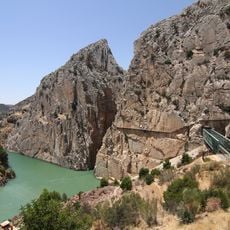
Caminito del Rey
452 m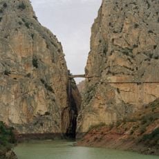
Desfiladero de los Gaitanes
696 m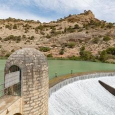
Gaitanejo Reservoir
2.1 km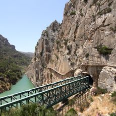
Puente del Gran Gaitán
1.1 km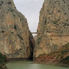
Desfiladero de los Gaitanes
477 m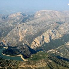
Embalse Superior Tajo de la Encantada
1.5 km
Salida Caminito del Rey
1.1 km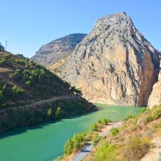
Embalse Tajo de la Encantada
1.3 km
Scenic viewpoint
1.3 km
Scenic viewpoint
1.8 km
Scenic viewpoint
881 m
Garganta del Chorro
543 m
Ermita de Nuestra Señora de Villaverde
474 m
Scenic viewpoint
459 m
Balcon de cristal
409 m
El Chorro Via Ferrata
1.4 km
Mirador de las Buitreras
1.5 km
Scenic viewpoint
367 m
Iglesia rupestre mozárabe de Bobastro
1.6 km
Scenic viewpoint
814 m
Scenic viewpoint
1.8 km
Commemorative plaque, memorial
1.9 km
Scenic viewpoint
1.9 km
Ruins
1.9 km
Scenic viewpoint
2 km
Scenic viewpoint
2.1 km
Scenic viewpoint
37 m
Nocne zdjęcie
2.1 kmReviews
Visited this place? Tap the stars to rate it and share your experience / photos with the community! Try now! You can cancel it anytime.
Discover hidden gems everywhere you go!
From secret cafés to breathtaking viewpoints, skip the crowded tourist spots and find places that match your style. Our app makes it easy with voice search, smart filtering, route optimization, and insider tips from travelers worldwide. Download now for the complete mobile experience.

A unique approach to discovering new places❞
— Le Figaro
All the places worth exploring❞
— France Info
A tailor-made excursion in just a few clicks❞
— 20 Minutes