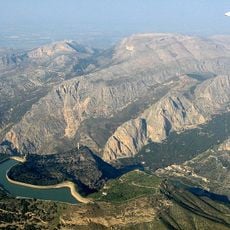
Desfiladero de los Gaitanes, Natural gorge in Malaga Province, Spain.
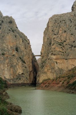
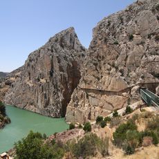
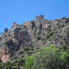
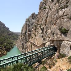
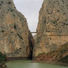
Desfiladero de los Gaitanes is a limestone canyon in Málaga Province where the Guadalhorce River winds through narrow, steep gorges. At some points the ravine narrows to less than 10 meters across, while the rock walls soar up to 400 meters high.
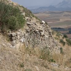
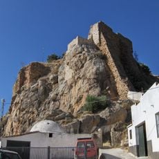
The gorge formed over millions of years as the river carved through soft limestone, creating this dramatic formation. In the 16th century the area served as a hideout for the Gaitanes, an infamous outlaw band.
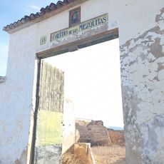
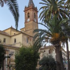
The name comes from the Gaitanes, a band of outlaws from the 16th century who hid in these remote hills. Today, visitors passing through experience a landscape shaped by centuries of human stories and local legends.
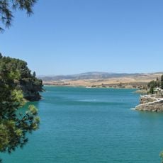
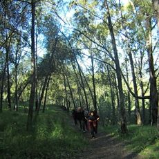
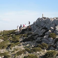
The site is accessible on foot with hiking trails and viewpoints that run along the gorge. The best time to explore is in spring or autumn when temperatures are mild and the risk of flooding is low.
The sheer rock faces are nesting sites for bearded eagles, golden eagles, and peregrine falcons that circle overhead daily. Visitors can watch these raptors perform their flying maneuvers, especially from the higher viewpoints.
Location: Andalusia
Location: Málaga Province
Inception: 1989
GPS coordinates: 36.91583,-4.77250
Latest update: December 7, 2025 19:27
Caminito del Rey
25 m
Guadalhorce-Guadalteba Reservoirs
4 km
Cueva de Ardales
6.9 km
Castillo
12.3 km
Centro de Visitantes El Torcal Alto
20.6 km
Castillo de la Estrella
14.8 km
Ciudad romana de Singilia Barba
18.1 km
Gaitanejo Reservoir
2.4 km
Balneario de Carratraca
8.2 km
Cortijo de las Mezquitas
20.2 km
Iglesia de Santa María del Reposo
16.7 km
Castillo Turón
10.8 km
Los Castillejos
14.5 km
Castillo de la Peña
7.8 km
Museo Histórico Municipal de Teba
15.3 km
Castillo de Ortegícar
16.7 km
Centro Histórico de Carratraca
8.2 km
Necrópolis prehistórica de Hacho
18.6 km
Castillo de Casarabonela
15.9 km
Puente del Gran Gaitán
626 m
Desfiladero de los Gaitanes
0 m
Silo de Campillos
15.4 km
Embalse del Conde de Guadalhorce
3.9 km
Embalse Superior Tajo de la Encantada
1.5 km
Yacimiento Nº 130 «Necrópolis de Ballesteros»
16.8 km
Yacimiento Nº 147 «Necrópolis de la colonia 02»
17 km
Fábrica de esencias de azahar Saisse Cavalier
12.7 km
La Huma
2.8 kmVisited this place? Tap the stars to rate it and share your experience / photos with the community! Try now! You can cancel it anytime.
Discover hidden gems everywhere you go!
From secret cafés to breathtaking viewpoints, skip the crowded tourist spots and find places that match your style. Our app makes it easy with voice search, smart filtering, route optimization, and insider tips from travelers worldwide. Download now for the complete mobile experience.
A unique approach to discovering new places❞
— Le Figaro
All the places worth exploring❞
— France Info
A tailor-made excursion in just a few clicks❞
— 20 Minutes