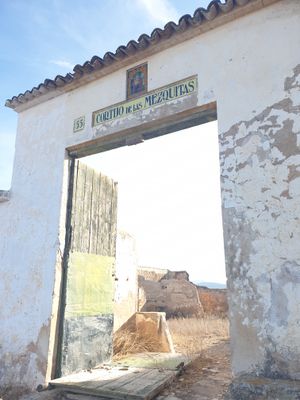
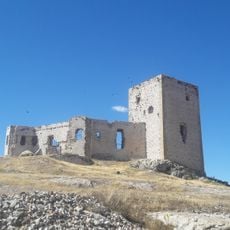
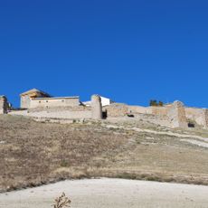
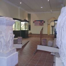
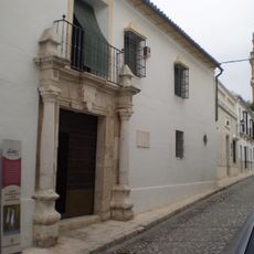
Cortijo de las Mezquitas, Former mosque and agricultural estate in Antequera, Spain
Cortijo de las Mezquitas is a former estate located between Antequera and Campillos with three naves separated by columns supporting horseshoe arches. The layout resembles architecture of major mosques and shows careful space division originally designed for communal gatherings.
The building was constructed in the 10th century during the reign of Caliph Abd al-Rahman III and served as a gathering place. After 1552 it was converted into an agricultural property and its original function was abandoned.
The structure displays Islamic architectural features with horseshoe arches that reference celebrated mosques of the era. The columned halls and their proportions reveal skilled craftsmanship from a period of religious importance.
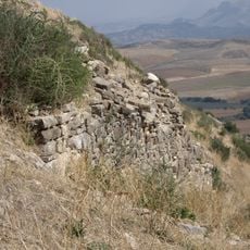
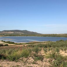
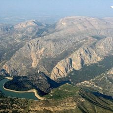
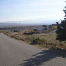
The site sits in a rural area between two municipalities and is best reached via local roads. Visitors should wear sturdy shoes since the terrain is uneven and the ruins offer limited pathways.
The central courtyard maintains an almost perfect square shape measuring about 28 meters on each side. Its walls incorporate stones from Roman settlements in the area, binding two cultures within one structure.
Location: Antequera
Location: Campillos
Inception: 9 century
GPS coordinates: 37.09158,-4.82745
Latest update: December 14, 2025 18:05
Caminito del Rey
20.2 km
Desfiladero de los Gaitanes
20.2 km
Guadalhorce-Guadalteba Reservoirs
16.8 km
Castillo de la Estrella
14.8 km
Ciudad romana de Singilia Barba
18.7 km
Gaitanejo Reservoir
18.2 km
Iglesia de Santa María del Reposo
5.8 km
Castillo-Palacio
22.3 km
Los Castillejos
18.7 km
Iglesia Parroquial de la Inmaculada Concepción
9.8 km
Colección Museográfica de Arte e Historia de Gilena
19.5 km
Museo Histórico Municipal de Teba
14.7 km
Castillo de Ortegícar
22.3 km
Biblioteca Pública Municipal de Martín de la Jara - Antonio Machado
12.3 km
Puente del Gran Gaitán
20.6 km
Laguna del Gosque
11.3 km
Iglesia de Nuestra Señora del Rosario
12 km
Iglesia Parroquial de Santiago el Mayor
13.8 km
Embalse del Conde de Guadalhorce
19.5 km
Silo de Campillos
7.3 km
Embalse Superior Tajo de la Encantada
21.4 km
Yacimiento Nº 130 «Necrópolis de Ballesteros»
9.8 km
Centro de Visitantes José Antonio Valverde, Laguna de Fuente de Piedra
8.8 km
Yacimiento Nº 147 «Necrópolis de la colonia 02»
9.7 km
Centro Histórico de Estepa
22.3 km
Embalse Tajo de la Encantada
20.9 km
Museo Arqueológico Padre Martín Recio
22.5 km
La Huma
19.5 kmVisited this place? Tap the stars to rate it and share your experience / photos with the community! Try now! You can cancel it anytime.
Discover hidden gems everywhere you go!
From secret cafés to breathtaking viewpoints, skip the crowded tourist spots and find places that match your style. Our app makes it easy with voice search, smart filtering, route optimization, and insider tips from travelers worldwide. Download now for the complete mobile experience.
A unique approach to discovering new places❞
— Le Figaro
All the places worth exploring❞
— France Info
A tailor-made excursion in just a few clicks❞
— 20 Minutes