
Heidenkopfturm
Location: Ormesheim
Location: Mandelbachtal
Inception: January 1, 1973
Accessibility: Wheelchair inaccessible
Fee: No
Website: https://panoramax.openstreetmap.fr/?s=fp;s2;p41ad6ae6-2848-4bdb-a2c7-4473cb9da074;c79.00/0.00/0;m17.4/49.174491/7.133148;bs
Made from material: wood
GPS coordinates: 49.17446,7.13321
Latest update: November 20, 2025 03:31

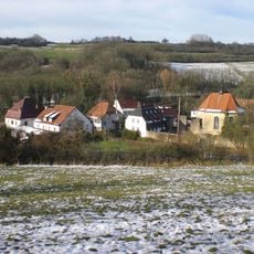
Kloster Gräfinthal
1.8 km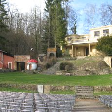
Naturbühne Gräfinthal
1.5 km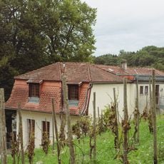
Haus Lochfeld
1.4 km
Naturschutzgebiet "Umgebung Gräfinthal" (N 6808-304)
1.8 km
Naturschutzgebiet "Muschelkalkhänge bei Bebelsheim und Wittersheim" (N 6808-303)
1.3 km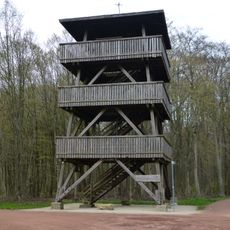
Heidenkopf-Tower
2 m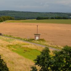
Optischer Telegraph
155 m
Muschelkalkhänge bei Bebelsheim u. Wittersheim
1.6 km
Zwischen Hartungshof und Schorrenwald
1.7 km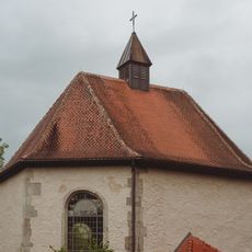
Kapelle Gräfinthal
1.8 km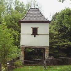
Taubenhaus
1.8 km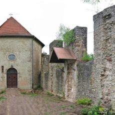
Ruine der Klosterkirche
1.8 km
Brudermannsklause
1.6 km
LSG in Mandelbachtal (ehem. Landkreis St. Ingbert)
1.7 km
Parcours Start
1.8 km
Parcours Station 1
1.6 km
Scenic viewpoint
1.4 km
Wayside cross
1 km
Wayside cross, Christianity
1.6 km
Wayside cross
1.6 km
Wayside cross, Christianity
1.7 km
Christianity, wayside cross
1.7 km
Water well
1.8 km
Wayside cross, Christianity
1.6 km
Wayside cross, Christianity
1.8 km
Wayside cross
1.5 km
Wayside cross
1.8 km
Wayside cross
1.8 kmReviews
Visited this place? Tap the stars to rate it and share your experience / photos with the community! Try now! You can cancel it anytime.
Discover hidden gems everywhere you go!
From secret cafés to breathtaking viewpoints, skip the crowded tourist spots and find places that match your style. Our app makes it easy with voice search, smart filtering, route optimization, and insider tips from travelers worldwide. Download now for the complete mobile experience.

A unique approach to discovering new places❞
— Le Figaro
All the places worth exploring❞
— France Info
A tailor-made excursion in just a few clicks❞
— 20 Minutes