
Ritterstein 240 "Höhle - Bürgermeisterstein ..."
Location: Diedesfeld
Location: Neustadt an der Weinstraße
Reference: 240
Inscription: Höhle Bürgermeisterstein Spätmittelalter Hausmarken P.W.V.
Made from material: sandstone
GPS coordinates: 49.32609,8.08320
Latest update: October 25, 2025 10:56
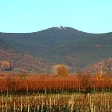
Kalmit
766 m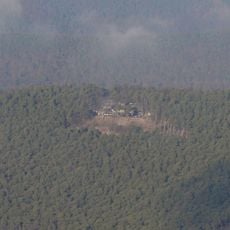
Hohe Loog (Haardt)
1.2 km
Kalmithöhenstraße
796 m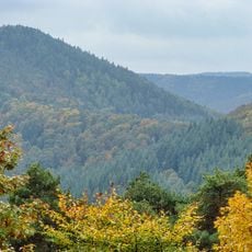
Hahnenschritt
367 m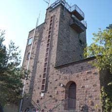
Kalmit Observation Tower
775 m
Rittersberg
1.8 km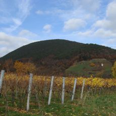
Sommerberg
1.7 km
Zwergberg
185 m
Sternberg
1 km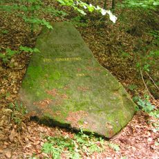
Ritterstein 189 "Emil Ohler Pfad"
1.5 km
Ritterstein 239 "Huettenhohl Ruine Alte Huette"
1.6 km
Weinrebe
1.1 km
Scenic viewpoint
790 m
Commemorative plaque, memorial
810 m
Memorial, commemorative plaque
813 m
Bench, scenic viewpoint
257 m
Scenic viewpoint
1.1 km
Bildbaum
692 m
Kalmitblick
1.1 km
Memorial, commemorative plaque
1.1 km
Gefallenendenkmal PWV 1914
797 m
Scenic viewpoint
1.2 km
Scenic viewpoint
1.3 km
Felsenmeer
1.5 km
Memorial, Obelisk
788 m
Hambacher Sauhäusel
786 m
Jobs Blum
780 m
Scenic viewpoint
1.7 kmReviews
Visited this place? Tap the stars to rate it and share your experience / photos with the community! Try now! You can cancel it anytime.
Discover hidden gems everywhere you go!
From secret cafés to breathtaking viewpoints, skip the crowded tourist spots and find places that match your style. Our app makes it easy with voice search, smart filtering, route optimization, and insider tips from travelers worldwide. Download now for the complete mobile experience.

A unique approach to discovering new places❞
— Le Figaro
All the places worth exploring❞
— France Info
A tailor-made excursion in just a few clicks❞
— 20 Minutes