Ritterstein 27 "Signal"
Location: Böllenborn
Reference: 27
Inscription: Signal PWV.
Made from material: sandstone
GPS coordinates: 49.08622,7.91391
Latest update: November 23, 2025 16:37
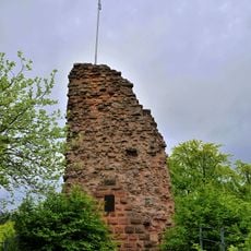
Guttenberg Castle
1.1 km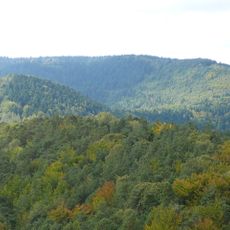
Hohe Derst
10 m
Ritterstein 12 "Schanze 1704"
1.5 km
Großer Eichelberg
1.2 km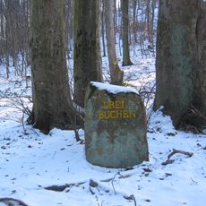
Ritterstein 14 "Drei Buchen"
1.3 km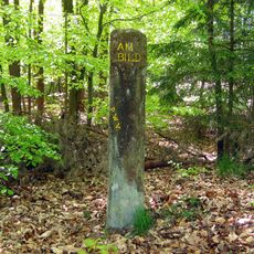
Ritterstein 23 "Am Bild"
952 m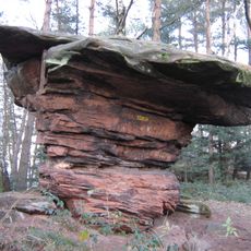
Ritterstein 20 "Tisch"
412 m
Ritterstein 15 "R. Schlosshütte"
885 m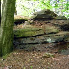
Ritterstein 18 "Hühnerfels"
545 m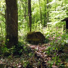
Ritterstein 21 "Drei Eichen"
869 m
Farrenberg
1.4 km
Kanzel-Berg
436 m
Scenic viewpoint
1.1 km
Steinerner Tisch
412 m
Scenic viewpoint
513 m
Ritterstein 13 "Hirschtränke"
1.4 km
Scenic viewpoint
343 m
Scenic viewpoint
135 m
Scenic viewpoint
1.1 km
Scenic viewpoint
331 m
Ehemaliges Schulhaus Reisdorf
1.2 km
Memorial
1.1 km
Mundatwald
1.1 km
Memorial stone, memorial
120 m
Kuhtriftpfad
690 m
Mundatwald
1.1 km
Elwetritsche Balzplatz
1.3 km
Memorial stone, memorial
1.3 kmReviews
Visited this place? Tap the stars to rate it and share your experience / photos with the community! Try now! You can cancel it anytime.
Discover hidden gems everywhere you go!
From secret cafés to breathtaking viewpoints, skip the crowded tourist spots and find places that match your style. Our app makes it easy with voice search, smart filtering, route optimization, and insider tips from travelers worldwide. Download now for the complete mobile experience.

A unique approach to discovering new places❞
— Le Figaro
All the places worth exploring❞
— France Info
A tailor-made excursion in just a few clicks❞
— 20 Minutes