
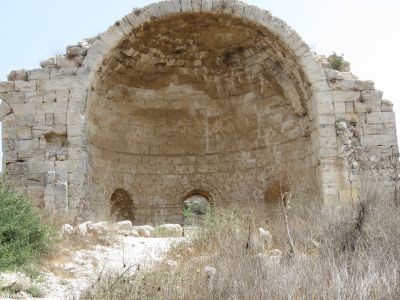
Church of Sandahana
Location: מועצה אזורית לכיש
GPS coordinates: 31.59552,34.90450
Latest update: November 12, 2025 20:57
Beit Guvrin National Park
2 km
Maresha
658 m
El Azi Villa
1.7 km
Gibelin
2.4 km
Beit Govrin Police Station
2.1 km
Me‘arot Bet Guvrin
1.1 km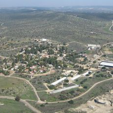
Eleutheropolis amphitheatre
1.7 km
Me'arat Torim
512 m
Me'arat H̱alulim
601 m
Me'arat Bat Sheva
2 km
Me'arat Ehud
2.4 km
Me‘arot Seret
1.8 km
Me'arat Avigayil
779 m
Me'arat Aẖino'am
978 m
Me'arat H̱aggit
1.4 km
Scenic viewpoint
654 m
Scenic viewpoint
570 m
Agricultural Area
824 m
תל מרשה
682 m
מערת הפעמון
880 m
Ruins
914 m
מערות כוכים
1.1 km
וילת בית גוברין
1.7 km
בית הקשתות
1.7 km
בית הרופא
1.6 km
קבר תמים א-דארי
2.5 km
בית הרופא
1.6 km
חורבה עם מערות מסתור
3.1 kmReviews
Visited this place? Tap the stars to rate it and share your experience / photos with the community! Try now! You can cancel it anytime.
Discover hidden gems everywhere you go!
From secret cafés to breathtaking viewpoints, skip the crowded tourist spots and find places that match your style. Our app makes it easy with voice search, smart filtering, route optimization, and insider tips from travelers worldwide. Download now for the complete mobile experience.

A unique approach to discovering new places❞
— Le Figaro
All the places worth exploring❞
— France Info
A tailor-made excursion in just a few clicks❞
— 20 Minutes