High water mark
Location: 豊岡市
Inscription: 平成16年台風23号で0.5m浸水しました
Made from material: concrete
GPS coordinates: 35.54679,134.81548
Latest update: November 18, 2025 22:56
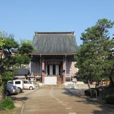
Raiko-ji Buddhist Temple
701 m
Shinko-ji
623 m
Wayside shrine
651 m
High water mark
640 m
和久田口の碑
733 m
世界連邦平和都市碑
747 m
出世大師
223 m
立江地蔵尊
315 m
Wayside shrine
604 m
Wayside shrine
409 m
Wayside shrine
758 m
Memorial
371 m
見待地蔵大菩薩
370 m
Wayside shrine
691 m
Work of art, statue, memorial
380 m
ぱちんこ村
127 m
High water mark
415 m
Wayside shrine, Buddhism
224 m
兵庫県立豊岡高等女学校正門跡
739 m
台風23号被災水深
520 m
Wayside shrine, Buddhism
609 m
High water mark
345 m
台風23号被災水深
617 m
High water mark
497 m
Buddhism, wayside shrine
762 m
Wayside shrine, Buddhism
722 m
田中寺
607 m
南無地蔵願王尊
591 mReviews
Visited this place? Tap the stars to rate it and share your experience / photos with the community! Try now! You can cancel it anytime.
Discover hidden gems everywhere you go!
From secret cafés to breathtaking viewpoints, skip the crowded tourist spots and find places that match your style. Our app makes it easy with voice search, smart filtering, route optimization, and insider tips from travelers worldwide. Download now for the complete mobile experience.

A unique approach to discovering new places❞
— Le Figaro
All the places worth exploring❞
— France Info
A tailor-made excursion in just a few clicks❞
— 20 Minutes