High water mark
Location: 豊岡市
Inception: March 1, 2008
Inscription: 平成16年台風23号で0.7m浸水しました。
Operator: 国土交通省
GPS coordinates: 35.54829,134.82064
Latest update: November 18, 2025 22:56
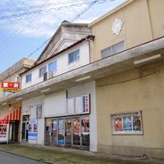
Toyooka Theater
439 m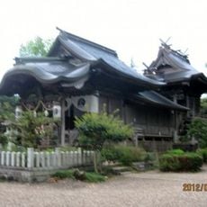
Odaiagata-jinja
362 m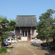
Raiko-ji Buddhist Temple
497 m
Shinko-ji
325 m
Memorial
177 m
出町大いと場跡
405 m
Work of art, statue
501 m
Statue, Work of art
397 m
Statue, Work of art
406 m
Statue, Work of art
446 m
Statue, Work of art
449 m
Wayside shrine
488 m
Wayside shrine
375 m
Wayside shrine
519 m
Work of art, statue, memorial
177 m
Statue, Work of art
497 m
見待地蔵大菩薩
395 m
Wayside shrine
267 m
Wayside shrine
187 m
台風23号被災水深
484 m
High water mark
497 m
High water mark
150 m
High water mark
201 m
台風23号被災水深
233 m
High water mark
512 m
Wayside shrine, Buddhism
369 m
田中寺
488 m
南無地蔵願王尊
466 mReviews
Visited this place? Tap the stars to rate it and share your experience / photos with the community! Try now! You can cancel it anytime.
Discover hidden gems everywhere you go!
From secret cafés to breathtaking viewpoints, skip the crowded tourist spots and find places that match your style. Our app makes it easy with voice search, smart filtering, route optimization, and insider tips from travelers worldwide. Download now for the complete mobile experience.

A unique approach to discovering new places❞
— Le Figaro
All the places worth exploring❞
— France Info
A tailor-made excursion in just a few clicks❞
— 20 Minutes