Cannon
Location: Stroud
Location: Mid-Coast Council
GPS coordinates: -32.40689,151.96621
Latest update: November 21, 2025 05:45
Ghin-Doo-Ee National Park
20.1 km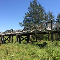
Monkerai Bridge over Karuah River
16 km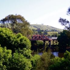
Clarence Town Bridge over Williams River
26 km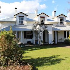
Stroud House
550 m
Cooreei Bridge over Williams River
19 km
St John the Evangelist Anglican Church, Stroud
229 m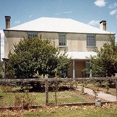
Gundayne House
7.5 km
Karuah National Park
20.3 km
Waterhen Park
26 km
Myall River Park
22.8 km
Tallowwood Forest Park
17 km
Bulahdelah Lions Park
22.4 km
Alderley Creek Winery
3.9 km
Mountain Lookout
24.1 km
Bulahdelah Golf Course
24.2 km
Big Bass
22.7 km
Platypus Point
17.5 km
Farmers Wife Distillery
15.8 km
Statue, Work of art
26.1 km
Historic Monkerai Bridge
16.1 km
Monument
19.6 km
Cannon
16 m
ANZAC memorial
297 m
Our Girls Memorial
21.9 km
Clarence Town Falls
25.8 km
Fords Falls
21 km
Mill Flat Falls
23.1 km
Rowlands Falls
24.1 kmReviews
Visited this place? Tap the stars to rate it and share your experience / photos with the community! Try now! You can cancel it anytime.
Discover hidden gems everywhere you go!
From secret cafés to breathtaking viewpoints, skip the crowded tourist spots and find places that match your style. Our app makes it easy with voice search, smart filtering, route optimization, and insider tips from travelers worldwide. Download now for the complete mobile experience.

A unique approach to discovering new places❞
— Le Figaro
All the places worth exploring❞
— France Info
A tailor-made excursion in just a few clicks❞
— 20 Minutes