Wayside shrine
Location: Heiligenblut am Großglockner
Inception: January 1, 1905
GPS coordinates: 47.04487,12.80744
Latest update: November 21, 2025 04:46
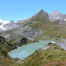
Stausee Margaritze
4.1 km
Téléphérique-tunnel de Fleissalm
3.4 km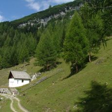
Bricciuskapelle Heiligenblut
1.8 km
Gipperkapelle, Maria Hilf
1.7 km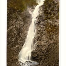
Leiterfall
1.9 km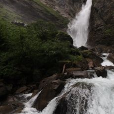
Gößnitzfall
446 m
Bauernhof (Anlage), Unterer Wegscheider
3.8 km
Scenic viewpoint
3.8 km
Wayside cross
345 m
Scenic viewpoint
599 m
Scenic viewpoint
439 m
Kirche und Großglockner
2.8 km
Scenic viewpoint
2.4 km
Scenic viewpoint
194 m
Work of art
1.5 km
Catholic church building, wayside cross, Christianity
1.4 km
Catholic church building, wayside cross, Christianity
1.9 km
Bergsteigerdenkmal
2.6 km
Work of art
585 m
Memorial, commemorative plaque
420 m
Memorial, commemorative plaque
802 m
Memorial, commemorative plaque
3.9 km
Wayside cross
635 m
Wayside cross
2.7 km
Wayside cross
1.2 km
Gössnitzfall
439 m
Waterfall
2.5 km
Möllfall
3.7 kmReviews
Visited this place? Tap the stars to rate it and share your experience / photos with the community! Try now! You can cancel it anytime.
Discover hidden gems everywhere you go!
From secret cafés to breathtaking viewpoints, skip the crowded tourist spots and find places that match your style. Our app makes it easy with voice search, smart filtering, route optimization, and insider tips from travelers worldwide. Download now for the complete mobile experience.

A unique approach to discovering new places❞
— Le Figaro
All the places worth exploring❞
— France Info
A tailor-made excursion in just a few clicks❞
— 20 Minutes