Wayside shrine
Location: Bad Mitterndorf
Inscription: Bei der Holzbringung vom Niederblos verunglückte am 22ten März 1827 Anton Stocker im 53. Lebensjahr verschütt von eina Schneelahn
GPS coordinates: 47.58799,14.02756
Latest update: November 17, 2025 12:02
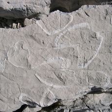
Dachstein Formation
2.5 km
Traweng
2 km
Kath. Filialkirche Hl. Dreifaltigkeit Tauplitz
2.2 km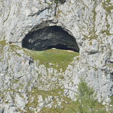
Käferloch
2.2 km
Sagtümpel
649 m
Grubstein-Westwandhöhle
2.8 km
DÖF sun-wire system of caves
1.4 km
Pfarrkirche zum Heiligen Kreuz, Tauplitz
3.2 km
Leistalm
3 km
Tauplitzer Wasserfall
1.2 km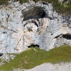
Grubsteinhöhle
2.3 km
In den Karen
2.5 km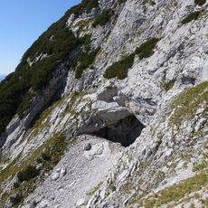
Grubstein-Eishöhle
2.9 km
Aufbahrungshalle
3.2 km
Wayside cross
1.3 km
Wayside cross
1.3 km
Scenic viewpoint
2.9 km
Scenic viewpoint
1.7 km
Scenic viewpoint
1.3 km
Wayside shrine
1.3 km
Mühle
1.3 km
Scenic viewpoint
1.2 km
Jungbauerkreuz
2.6 km
Dietmar Canaris
2 km
Grete Hierzegger
1.2 km
Wayside shrine
2.7 km
Pavel Suchánek
1.9 km
Gottfried Schachner
2.5 kmReviews
Visited this place? Tap the stars to rate it and share your experience / photos with the community! Try now! You can cancel it anytime.
Discover hidden gems everywhere you go!
From secret cafés to breathtaking viewpoints, skip the crowded tourist spots and find places that match your style. Our app makes it easy with voice search, smart filtering, route optimization, and insider tips from travelers worldwide. Download now for the complete mobile experience.

A unique approach to discovering new places❞
— Le Figaro
All the places worth exploring❞
— France Info
A tailor-made excursion in just a few clicks❞
— 20 Minutes