Wayside shrine
Location: Bayerisch Eisenstein
GPS coordinates: 49.12329,13.19464
Latest update: November 13, 2025 06:42
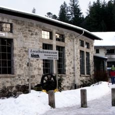
Localbahnmuseum Bayerisch Eisenstein
808 m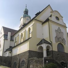
Pfarrkirche St. Johannes Nepomuk
618 m
Kapelle mit Dachreiter
266 m
Parkvilla
512 m
Loading ramps at Bayerisch Eisenstein station
917 m
Scheune Hatzingerhof 17 in Bayerisch Eisenstein
33 m
Residential building at Bayerisch Eisenstein station
757 m
Pfarrhaus Bahnhofstraße 18 in Bayerisch Eisenstein
617 m
Kriegerdenkmal Bahnhofstraße 20 in Bayerisch Eisenstein
583 m
Hofmauer Hauptstraße 33 a in Bayerisch Eisenstein
504 m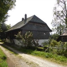
Hatzinger-Hof
18 m
Residential building at Bayerisch Eisenstein station
714 m
Scheune Brennesstraße 11 in Bayerisch Eisenstein
209 m
Residential building at Bayerisch Eisenstein station
735 m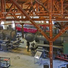
Railway roundhouse at Bayerisch Eisenstein station
813 m
Einfriedung Hatzingerhof 17 in Bayerisch Eisenstein
25 m
Wohn- und Geschäftshaus
696 m
Bahnwärterhaus
622 m
Gartenpavillon Hauptstraße 33 in Bayerisch Eisenstein
541 m
Ehemaliges Glashüttenwohnhaus
235 m
1933-1951
800 m
Wayside cross
740 m
1931- Alois Höfner
716 m
Kriegerdenkmal
586 m
Riepl-Kreuz
421 m
Erster Friedhof 1809-1922
409 m
Wayside cross
481 m
Totenbretter mit Wegkreuz
532 mReviews
Visited this place? Tap the stars to rate it and share your experience / photos with the community! Try now! You can cancel it anytime.
Discover hidden gems everywhere you go!
From secret cafés to breathtaking viewpoints, skip the crowded tourist spots and find places that match your style. Our app makes it easy with voice search, smart filtering, route optimization, and insider tips from travelers worldwide. Download now for the complete mobile experience.

A unique approach to discovering new places❞
— Le Figaro
All the places worth exploring❞
— France Info
A tailor-made excursion in just a few clicks❞
— 20 Minutes